

168
H. Siegel et al.
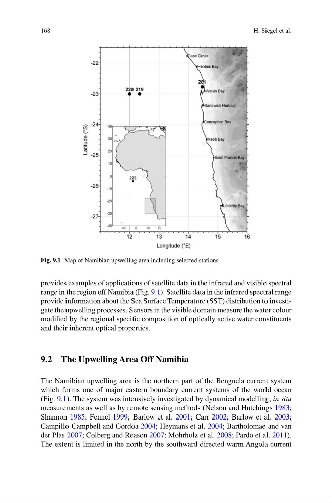
Fig. 9.1 Map of Namibian upwelling area including selected stations
provides examples of applications of satellite data in the infrared and visible spectral
range in the region off Namibia (Fig. 9.1). Satellite data in the infrared spectral range
provide information about the Sea Surface Temperature (SST) distribution to investigate the upwelling processes. Sensors in the visible domain measure the water colour
modified by the regional specific composition of optically active water constituents
and their inherent optical properties.
9.2 The Upwelling Area Off Namibia
The Namibian upwelling area is the northern part of the Benguela current system
which forms one of major eastern boundary current systems of the world ocean
(Fig. 9.1). The system was intensively investigated by dynamical modelling, in situ
measurements as well as by remote sensing methods (Nelson and Hutchings 1983;
Shannon 1985; Fennel 1999; Barlow et al. 2001; Carr 2002; Barlow et al. 2003;
Campillo-Campbell and Gordoa 2004; Heymans et al. 2004; Bartholomae and van
der Plas 2007; Colberg and Reason 2007; Mohrholz et al. 2008; Pardo et al. 2011).
The extent is limited in the north by the southward directed warm Angola current
H. Siegel et al.
Fig. 9.1 Map of Namibian upwelling area including selected stations
provides examples of applications of satellite data in the infrared and visible spectral
range in the region off Namibia (Fig. 9.1). Satellite data in the infrared spectral range
provide information about the Sea Surface Temperature (SST) distribution to investigate the upwelling processes. Sensors in the visible domain measure the water colour
modified by the regional specific composition of optically active water constituents
and their inherent optical properties.
9.2 The Upwelling Area Off Namibia
The Namibian upwelling area is the northern part of the Benguela current system
which forms one of major eastern boundary current systems of the world ocean
(Fig. 9.1). The system was intensively investigated by dynamical modelling, in situ
measurements as well as by remote sensing methods (Nelson and Hutchings 1983;
Shannon 1985; Fennel 1999; Barlow et al. 2001; Carr 2002; Barlow et al. 2003;
Campillo-Campbell and Gordoa 2004; Heymans et al. 2004; Bartholomae and van
der Plas 2007; Colberg and Reason 2007; Mohrholz et al. 2008; Pardo et al. 2011).
The extent is limited in the north by the southward directed warm Angola current