

In African arid and semiarid regions, rainfall amounts vary drastically within a
season and between seasons; as such, surface water availability can radically
change. Detecting the change when surface water sites are filled by rainfalls and
when they are drained out is key information for the assessment of water availability and environmental conditions, providing alerts on vector-/insect-borne diseases
or managing human activities. Combal et al. [18] used the VEGETATION instrument onboard SPOT satellites to detect surface water, using the NIR at a resolution
of 1 km over Africa. The surface water was detected every 10 days and broadcast to
users by means of the EUMETCast broadcasting system operated by EUMETSAT.
EUMETCast is a multiservice dissemination system that uses geostationary satellites to multi-cast data to a wide user community. The detection of surface water
coupled with the broadcasting system provided the capacity for operational monitoring of surface water at continental to regional scales. The continuity of surface
observations allowed for seasonal assessment of water availability [18].
Where clouds, trees, and other vegetation obscure the water surface, synthetic
aperture radar (SAR) can be used to detect surface water. SAR can penetrate clouds
to detect standing water through emergent aquatic plants and forest canopies
[19]. Water bodies scatter the pulses emitted by radars. Since most SAR sensors
use a side-looking antenna, open waters appear dark as the radar pulses are not
returned (backscattered) to the radar antenna. If a wet surface is covered by
vegetation, the radar pulse bounces between the vegetation and wet surface, and
the backscattered return signal will be stronger than if the surface would have been
dry [20]. Table 1 shows the characteristics of some typical SAR satellites. Note the
good ground resolution and different polarization features. Some newer satellites
are also operating in the L-band (15–30 cm) and X-band (2.4–3.75 cm).
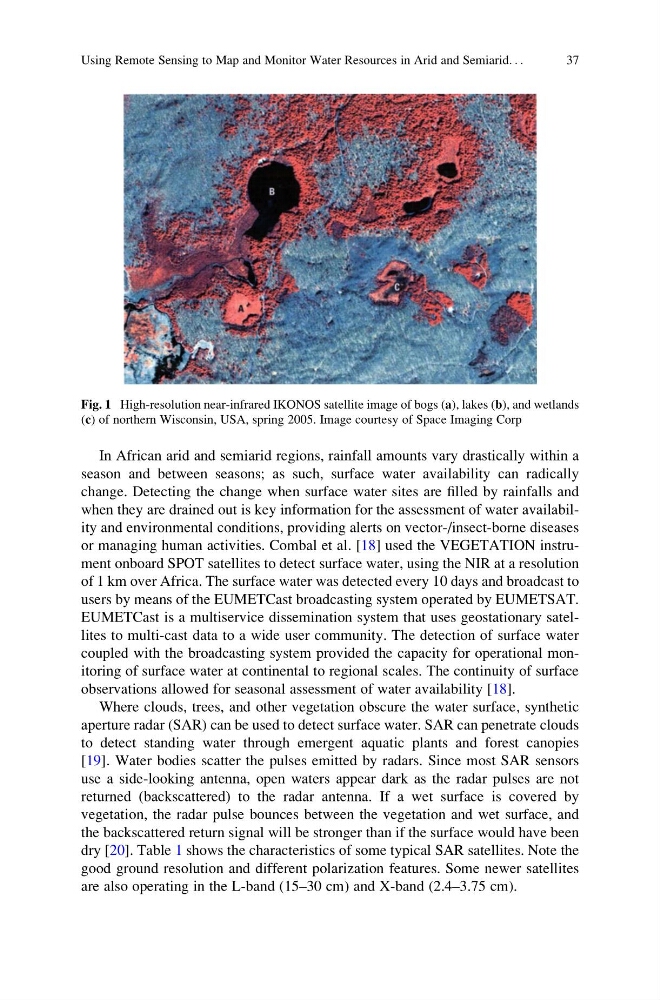
Fig. 1 High-resolution near-infrared IKONOS satellite image of bogs (a), lakes (b), and wetlands
(c) of northern Wisconsin, USA, spring 2005. Image courtesy of Space Imaging Corp
Using Remote Sensing to Map and Monitor Water Resources in Arid and Semiarid. . .
37
season and between seasons; as such, surface water availability can radically
change. Detecting the change when surface water sites are filled by rainfalls and
when they are drained out is key information for the assessment of water availability and environmental conditions, providing alerts on vector-/insect-borne diseases
or managing human activities. Combal et al. [18] used the VEGETATION instrument onboard SPOT satellites to detect surface water, using the NIR at a resolution
of 1 km over Africa. The surface water was detected every 10 days and broadcast to
users by means of the EUMETCast broadcasting system operated by EUMETSAT.
EUMETCast is a multiservice dissemination system that uses geostationary satellites to multi-cast data to a wide user community. The detection of surface water
coupled with the broadcasting system provided the capacity for operational monitoring of surface water at continental to regional scales. The continuity of surface
observations allowed for seasonal assessment of water availability [18].
Where clouds, trees, and other vegetation obscure the water surface, synthetic
aperture radar (SAR) can be used to detect surface water. SAR can penetrate clouds
to detect standing water through emergent aquatic plants and forest canopies
[19]. Water bodies scatter the pulses emitted by radars. Since most SAR sensors
use a side-looking antenna, open waters appear dark as the radar pulses are not
returned (backscattered) to the radar antenna. If a wet surface is covered by
vegetation, the radar pulse bounces between the vegetation and wet surface, and
the backscattered return signal will be stronger than if the surface would have been
dry [20]. Table 1 shows the characteristics of some typical SAR satellites. Note the
good ground resolution and different polarization features. Some newer satellites
are also operating in the L-band (15–30 cm) and X-band (2.4–3.75 cm).
Fig. 1 High-resolution near-infrared IKONOS satellite image of bogs (a), lakes (b), and wetlands
(c) of northern Wisconsin, USA, spring 2005. Image courtesy of Space Imaging Corp
Using Remote Sensing to Map and Monitor Water Resources in Arid and Semiarid. . .
37