

using Eq. (1a) are sometimes reported in terms of consumptive use coefficients, that
is, consumptive loss as a percent of total withdrawal:
CU coefficient %
ð Þ ¼ 100 Â W À R
ð
Þ=W
ð1bÞ
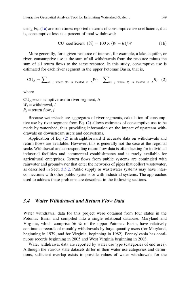
More generally, for a given resource of interest, for example, a lake, aquifer, or
river, consumptive use is the sum of all withdrawals from the resource minus the
sum of all return flows to the same resource. In this study, consumptive use is
estimated for each river segment in the upper Potomac Basin, that is,
CU A ¼
X
all i where W i is located in A
W i À
X
all j where R j is located in A
R j ð2Þ
where
CU A ¼ consumptive use in river segment, A
W i ¼ withdrawal, i
R j ¼ return flow, j
Because watersheds are aggregates of river segments, calculation of consumptive use by river segment from Eq. (2) allows estimates of consumptive use to be
made by watershed, thus providing information on the impact of upstream withdrawals on downstream users and ecosystems.
Application of Eq. (2) is straightforward if accurate data on withdrawals and
return flows are available. However, this is generally not the case at the regional
scale. Withdrawal and corresponding return flow data is often lacking for individual
industrial facilities and commercial establishments and is rarely available for
agricultural enterprises. Return flows from public systems are comingled with
rainwater and groundwater that enter the networks of pipes that collect wastewater,
as described in Sect. 3.5.2. Public supply or wastewater systems may have interconnections with other public systems or with industrial systems. The approaches
used to address these problems are described in the following sections.
3.4 Water Withdrawal and Return Flow Data
Water withdrawal data for this project were obtained from four states in the
Potomac Basin and compiled into a single relational database. Maryland and
Virginia, which comprise 56 % of the upper Potomac Basin, have relatively
continuous records of monthly withdrawals by large quantity users (for Maryland,
beginning in 1979, and for Virginia, beginning in 1982). Pennsylvania has continuous records beginning in 2005 and West Virginia beginning in 2003.
Water withdrawal data are reported by water use type (categories of end uses).
Although the various state datasets differ in their water use categories and definitions, sufficient overlap exists to provide values of water withdrawals for the
Interactive Geospatial Analysis Tool for Estimating Watershed-Scale. . .
149
is, consumptive loss as a percent of total withdrawal:
CU coefficient %
ð Þ ¼ 100 Â W À R
ð
Þ=W
ð1bÞ
More generally, for a given resource of interest, for example, a lake, aquifer, or
river, consumptive use is the sum of all withdrawals from the resource minus the
sum of all return flows to the same resource. In this study, consumptive use is
estimated for each river segment in the upper Potomac Basin, that is,
CU A ¼
X
all i where W i is located in A
W i À
X
all j where R j is located in A
R j ð2Þ
where
CU A ¼ consumptive use in river segment, A
W i ¼ withdrawal, i
R j ¼ return flow, j
Because watersheds are aggregates of river segments, calculation of consumptive use by river segment from Eq. (2) allows estimates of consumptive use to be
made by watershed, thus providing information on the impact of upstream withdrawals on downstream users and ecosystems.
Application of Eq. (2) is straightforward if accurate data on withdrawals and
return flows are available. However, this is generally not the case at the regional
scale. Withdrawal and corresponding return flow data is often lacking for individual
industrial facilities and commercial establishments and is rarely available for
agricultural enterprises. Return flows from public systems are comingled with
rainwater and groundwater that enter the networks of pipes that collect wastewater,
as described in Sect. 3.5.2. Public supply or wastewater systems may have interconnections with other public systems or with industrial systems. The approaches
used to address these problems are described in the following sections.
3.4 Water Withdrawal and Return Flow Data
Water withdrawal data for this project were obtained from four states in the
Potomac Basin and compiled into a single relational database. Maryland and
Virginia, which comprise 56 % of the upper Potomac Basin, have relatively
continuous records of monthly withdrawals by large quantity users (for Maryland,
beginning in 1979, and for Virginia, beginning in 1982). Pennsylvania has continuous records beginning in 2005 and West Virginia beginning in 2003.
Water withdrawal data are reported by water use type (categories of end uses).
Although the various state datasets differ in their water use categories and definitions, sufficient overlap exists to provide values of water withdrawals for the
Interactive Geospatial Analysis Tool for Estimating Watershed-Scale. . .
149