

427
However, ingress of effl uents and silt from the
River Bhagirathi are some of the threats to these
wetlands. Afforestation and initiation of a Nature
Park are some of the conservation measures.
20.3.23.2 The Sundarbans
These lie at an altitude range of 0–5 m, between
21° 32′ and 22° 20′ N and 88° 05′ and 89° 05′ E,
about 100 km SE of Kolkata in WB. Literally,
‘Sundarbans’ means ‘beautiful forests’. It comprises the outer portion of the Ganga–
Brahmaputra Delta. It is an extensive region of
tidal channels and islands covering about one
million ha and includes one of the largest contiguous blocks of mangrove forest in the world.
The Indian portion includes the deltaic region of
Hooghly-Matlah estuary and extends from the
Hooghly-Matlah estuary to Bangladesh border.
About 60 % of this extensive area lies in
Bangladesh. However, the Indian portion measures approx. 450,000 ha, of which the mangrove
forest is about 200,000 ha and the Tiger Reserve
is about 258,500 ha.
Notably, morphogenetic and tectonic changes
of the western margin had shifted the course of
the Ganges eastwards, and the infl ow of FW is
now almost exclusively confi ned to the monsoon
period. Consequently, there have been profound
changes in the fl oristic composition during the
past 600 years approx. The GOI had, thus, constructed the Farakka Barrage in 1971 in order to
avoid rapid siltation in the Calcutta Port.
The climate is tropical monsoon with an
annual average rainfall of 1,500–2,500 mm. High
waves of height 5–8 m affect the region. The temperature generally ranges from 9 to 35 °C, water
pH from 5.5 to 8.0 and salinity from 3.6 to
23.5 ppt. Principal vegetation has been classifi ed
under fi ve formations, namely , (a) mangrove
scrub, (b) saltwater mangrove forest, (c) a
Phoenix paludosa belt, (d) moderately saline
mixed forest with Heritiera fomes and (e) brackish water mixed forest dominated by Heritiera
fomes.
The Sundarbans have about 300 tigers, spotted
deer, wild boar, rhesus monkey and dolphins and
rich diversity of birds including adjutant stork,
endangered river terrapin and estuarine crocodile. Fish fauna include Mugil, Liza, Chanos,
Lates and Elops . Also, lobsters, like Penaeus , are
present. The Hooghly-Matlah estuary is a nursery
for both anadromous and catadromous fi shes.
Large areas have been embanked for human settlement and cultivation leaving behind very little
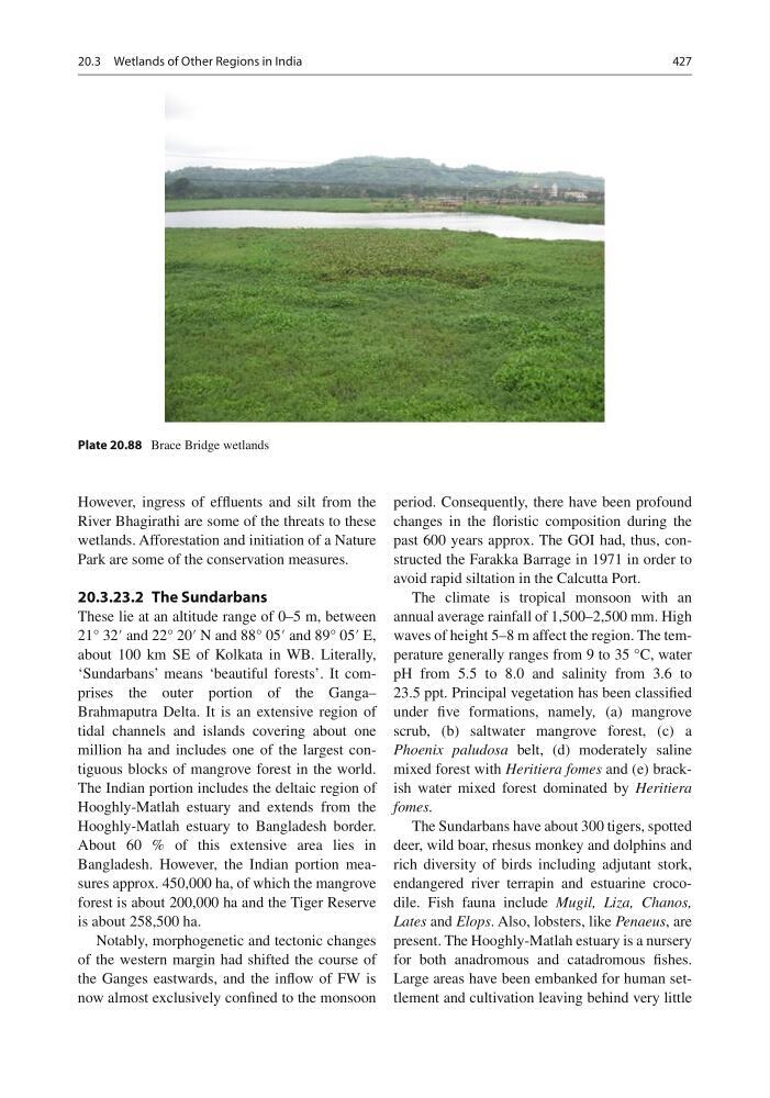
Plate 20.88 Brace Bridge wetlands
20.3 Wetlands of Other Regions in India
However, ingress of effl uents and silt from the
River Bhagirathi are some of the threats to these
wetlands. Afforestation and initiation of a Nature
Park are some of the conservation measures.
20.3.23.2 The Sundarbans
These lie at an altitude range of 0–5 m, between
21° 32′ and 22° 20′ N and 88° 05′ and 89° 05′ E,
about 100 km SE of Kolkata in WB. Literally,
‘Sundarbans’ means ‘beautiful forests’. It comprises the outer portion of the Ganga–
Brahmaputra Delta. It is an extensive region of
tidal channels and islands covering about one
million ha and includes one of the largest contiguous blocks of mangrove forest in the world.
The Indian portion includes the deltaic region of
Hooghly-Matlah estuary and extends from the
Hooghly-Matlah estuary to Bangladesh border.
About 60 % of this extensive area lies in
Bangladesh. However, the Indian portion measures approx. 450,000 ha, of which the mangrove
forest is about 200,000 ha and the Tiger Reserve
is about 258,500 ha.
Notably, morphogenetic and tectonic changes
of the western margin had shifted the course of
the Ganges eastwards, and the infl ow of FW is
now almost exclusively confi ned to the monsoon
period. Consequently, there have been profound
changes in the fl oristic composition during the
past 600 years approx. The GOI had, thus, constructed the Farakka Barrage in 1971 in order to
avoid rapid siltation in the Calcutta Port.
The climate is tropical monsoon with an
annual average rainfall of 1,500–2,500 mm. High
waves of height 5–8 m affect the region. The temperature generally ranges from 9 to 35 °C, water
pH from 5.5 to 8.0 and salinity from 3.6 to
23.5 ppt. Principal vegetation has been classifi ed
under fi ve formations, namely , (a) mangrove
scrub, (b) saltwater mangrove forest, (c) a
Phoenix paludosa belt, (d) moderately saline
mixed forest with Heritiera fomes and (e) brackish water mixed forest dominated by Heritiera
fomes.
The Sundarbans have about 300 tigers, spotted
deer, wild boar, rhesus monkey and dolphins and
rich diversity of birds including adjutant stork,
endangered river terrapin and estuarine crocodile. Fish fauna include Mugil, Liza, Chanos,
Lates and Elops . Also, lobsters, like Penaeus , are
present. The Hooghly-Matlah estuary is a nursery
for both anadromous and catadromous fi shes.
Large areas have been embanked for human settlement and cultivation leaving behind very little
Plate 20.88 Brace Bridge wetlands
20.3 Wetlands of Other Regions in India