

115
3.04 km, 6.0 m, 1.0 m, 11.45 km
2 and 15.5 km,
respectively. The lake usually portrays water
transparency 0.5–4.0 m, surface temperature
5.0–31.5 °C, pH 7.8–9.2, DO 6.2–11.0 mg l
−1
,
TA 70–120 mg l
−1
, Ca 10–28 mg l
−1
, Mg 2.0–
8.0 mg l
−1
, K 0.5–1.2 mg l
−1
, Na 4.0–6.2 mg l
−1
,
NO 3 40.0–350.0 μg l
−1
, PO 4 5.0–20.0 μg l
−1
,
silicate 0.5–3.0 mg l
−1 and conductivity 200–
475 μmhos cm
−1
. Zutshi (1989) noted a net
input of 4.36 t of P and 39.2 t of N/year in Dal
Lake. Further, it may be noted here that 500
fi ngerlings of common carp were released into
Lake Dal in 1956. Das and Subla (1970)
reported a sharp increase in common carp
catches in Lake Dal, with the once abundant
schizothoracine species having been virtually
ousted.
Manasbal Lake
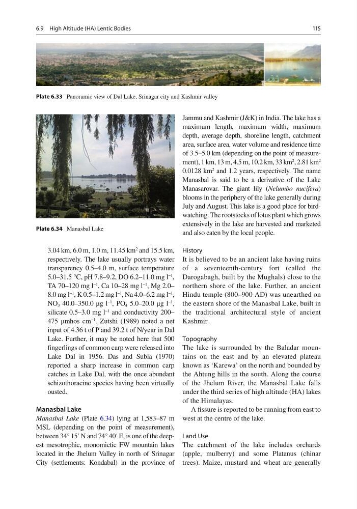
Manasbal Lake (Plate 6.34 ) lying at 1,583–87 m
MSL (depending on the point of measurement),
between 34° 15′ N and 74° 40′ E, is one of the deepest mesotrophic, monomictic FW mountain lakes
located in the Jhelum Valley in north of Srinagar
City (settlements: Kondabal) in the province of
Jammu and Kashmir (J&K) in India. The lake has a
maximum length, maximum width, maximum
depth, average depth, shoreline length, catchment
area, surface area, water volume and residence time
of 3.5–5.0 km (depending on the point of measurement), 1 km, 13 m, 4.5 m, 10.2 km, 33 km
2
, 2.81 km
2
0.0128 km
2 and 1.2 years, respectively. The name
Manasbal is said to be a derivative of the Lake
Manasarovar. The giant lily ( Nelumbo nucifera )
blooms in the periphery of the lake generally during
July and August. This lake is a good place for birdwatching. The rootstocks of lotus plant which grows
extensively in the lake are harvested and marketed
and also eaten by the local people.
History
It is believed to be an ancient lake having ruins
of a seventeenth-century fort (called the
Darogabagh, built by the Mughals) close to the
northern shore of the lake. Further, an ancient
Hindu temple (800–900 AD) was unearthed on
the eastern shore of the Manasbal Lake, built in
the traditional architectural style of ancient
Kashmir.
Topography
The lake is surrounded by the Baladar mountains on the east and by an elevated plateau
known as ‘Karewa’ on the north and bounded by
the Ahtung hills in the south. Along the course
of the Jhelum River, the Manasbal Lake falls
under the third series of high altitude (HA) lakes
of the Himalayas.
A fi ssure is reported to be running from east to
west at the centre of the lake.
Land Use
The catchment of the lake includes orchards
(apple, mulberry) and some Platanus (chinar
trees). Maize, mustard and wheat are generally
Plate 6.33 Panoramic view of Dal Lake, Srinagar city and Kashmir valley
Plate 6.34 Manasbal Lake
6.9 High Altitude (HA) Lentic Bodies
3.04 km, 6.0 m, 1.0 m, 11.45 km
2 and 15.5 km,
respectively. The lake usually portrays water
transparency 0.5–4.0 m, surface temperature
5.0–31.5 °C, pH 7.8–9.2, DO 6.2–11.0 mg l
−1
,
TA 70–120 mg l
−1
, Ca 10–28 mg l
−1
, Mg 2.0–
8.0 mg l
−1
, K 0.5–1.2 mg l
−1
, Na 4.0–6.2 mg l
−1
,
NO 3 40.0–350.0 μg l
−1
, PO 4 5.0–20.0 μg l
−1
,
silicate 0.5–3.0 mg l
−1 and conductivity 200–
475 μmhos cm
−1
. Zutshi (1989) noted a net
input of 4.36 t of P and 39.2 t of N/year in Dal
Lake. Further, it may be noted here that 500
fi ngerlings of common carp were released into
Lake Dal in 1956. Das and Subla (1970)
reported a sharp increase in common carp
catches in Lake Dal, with the once abundant
schizothoracine species having been virtually
ousted.
Manasbal Lake
Manasbal Lake (Plate 6.34 ) lying at 1,583–87 m
MSL (depending on the point of measurement),
between 34° 15′ N and 74° 40′ E, is one of the deepest mesotrophic, monomictic FW mountain lakes
located in the Jhelum Valley in north of Srinagar
City (settlements: Kondabal) in the province of
Jammu and Kashmir (J&K) in India. The lake has a
maximum length, maximum width, maximum
depth, average depth, shoreline length, catchment
area, surface area, water volume and residence time
of 3.5–5.0 km (depending on the point of measurement), 1 km, 13 m, 4.5 m, 10.2 km, 33 km
2
, 2.81 km
2
0.0128 km
2 and 1.2 years, respectively. The name
Manasbal is said to be a derivative of the Lake
Manasarovar. The giant lily ( Nelumbo nucifera )
blooms in the periphery of the lake generally during
July and August. This lake is a good place for birdwatching. The rootstocks of lotus plant which grows
extensively in the lake are harvested and marketed
and also eaten by the local people.
History
It is believed to be an ancient lake having ruins
of a seventeenth-century fort (called the
Darogabagh, built by the Mughals) close to the
northern shore of the lake. Further, an ancient
Hindu temple (800–900 AD) was unearthed on
the eastern shore of the Manasbal Lake, built in
the traditional architectural style of ancient
Kashmir.
Topography
The lake is surrounded by the Baladar mountains on the east and by an elevated plateau
known as ‘Karewa’ on the north and bounded by
the Ahtung hills in the south. Along the course
of the Jhelum River, the Manasbal Lake falls
under the third series of high altitude (HA) lakes
of the Himalayas.
A fi ssure is reported to be running from east to
west at the centre of the lake.
Land Use
The catchment of the lake includes orchards
(apple, mulberry) and some Platanus (chinar
trees). Maize, mustard and wheat are generally
Plate 6.33 Panoramic view of Dal Lake, Srinagar city and Kashmir valley
Plate 6.34 Manasbal Lake
6.9 High Altitude (HA) Lentic Bodies