

13 Can We use a Landscape Approach to Assess Natural and Anthropogenic . . .
213
Recreational hand-fishing activity
BR
Boulder field 2
FB
FB
Boulder field 1
MB
FB
FB
MB
FB
FB
MB
FB
FB
MB
Low disturbed site
Moderately disturbed site
Highly disturbed site
Boulder field 3
Boulder field 4
Undisturbed site
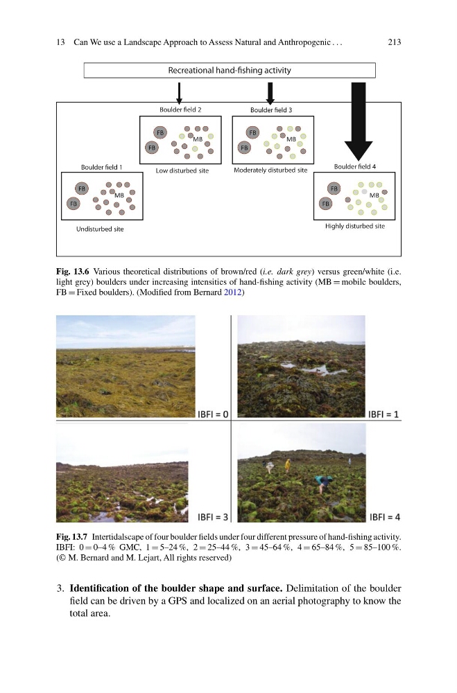
Fig. 13.6 Various theoretical distributions of brown/red (i.e. dark grey) versus green/white (i.e.
light grey) boulders under increasing intensities of hand-fishing activity (MB = mobile boulders,
FB = Fixed boulders). (Modified from Bernard 2012)
Fig. 13.7 Intertidalscape of four boulder fields under four different pressure of hand-fishing activity.
IBFI: 0 = 0–4 % GMC, 1 = 5–24 %, 2 = 25–44 %, 3 = 45–64 %, 4 = 65–84 %, 5 = 85–100 %.
(© M. Bernard and M. Lejart, All rights reserved)
3. Identification of the boulder shape and surface. Delimitation of the boulder
field can be driven by a GPS and localized on an aerial photography to know the
total area.
213
Recreational hand-fishing activity
BR
Boulder field 2
FB
FB
Boulder field 1
MB
FB
FB
MB
FB
FB
MB
FB
FB
MB
Low disturbed site
Moderately disturbed site
Highly disturbed site
Boulder field 3
Boulder field 4
Undisturbed site
Fig. 13.6 Various theoretical distributions of brown/red (i.e. dark grey) versus green/white (i.e.
light grey) boulders under increasing intensities of hand-fishing activity (MB = mobile boulders,
FB = Fixed boulders). (Modified from Bernard 2012)
Fig. 13.7 Intertidalscape of four boulder fields under four different pressure of hand-fishing activity.
IBFI: 0 = 0–4 % GMC, 1 = 5–24 %, 2 = 25–44 %, 3 = 45–64 %, 4 = 65–84 %, 5 = 85–100 %.
(© M. Bernard and M. Lejart, All rights reserved)
3. Identification of the boulder shape and surface. Delimitation of the boulder
field can be driven by a GPS and localized on an aerial photography to know the
total area.