

Chapter 26 A Landscape Perspective
639
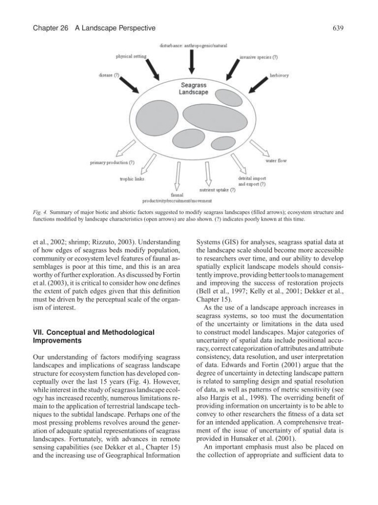
Fig. 4. Summary of major biotic and abiotic factors suggested to modify seagrass landscapes (filled arrows); ecosystem structure and
functions modified by landscape characteristics (open arrows) are also shown. (?) indicates poorly known at this time.
et al., 2002; shrimp; Rizzuto, 2003). Understanding
of how edges of seagrass beds modify population,
community or ecosystem level features of faunal assemblages is poor at this time, and this is an area
worthy of further exploration. As discussed by Fortin
et al. (2003), it is critical to consider how one defines
the extent of patch edges given that this definition
must be driven by the perceptual scale of the organism of interest.
VII. Conceptual and Methodological
Improvements
Our understanding of factors modifying seagrass
landscapes and implications of seagrass landscape
structure for ecosystem function has developed conceptually over the last 15 years (Fig. 4). However,
while interest in the study of seagrass landscape ecology has increased recently, numerous limitations remain to the application of terrestrial landscape techniques to the subtidal landscape. Perhaps one of the
most pressing problems revolves around the generation of adequate spatial representations of seagrass
landscapes. Fortunately, with advances in remote
sensing capabilities (see Dekker et al., Chapter 15)
and the increasing use of Geographical Information
Systems (GIS) for analyses, seagrass spatial data at
the landscape scale should become more accessible
to researchers over time, and our ability to develop
spatially explicit landscape models should consistently improve, providing better tools to management
and improving the success of restoration projects
(Bell et al., 1997; Kelly et al., 2001; Dekker et al.,
Chapter 15).
As the use of a landscape approach increases in
seagrass systems, so too must the documentation
of the uncertainty or limitations in the data used
to construct model landscapes. Major categories of
uncertainty of spatial data include positional accuracy, correct categorization of attributes and attribute
consistency, data resolution, and user interpretation
of data. Edwards and Fortin (2001) argue that the
degree of uncertainty in detecting landscape pattern
is related to sampling design and spatial resolution
of data, as well as patterns of metric sensitivity (see
also Hargis et al., 1998). The overriding benefit of
providing information on uncertainty is to be able to
convey to other researchers the fitness of a data set
for an intended application. A comprehensive treatment of the issue of uncertainty of spatial data is
provided in Hunsaker et al. (2001).
An important emphasis must also be placed on
the collection of appropriate and sufficient data to