

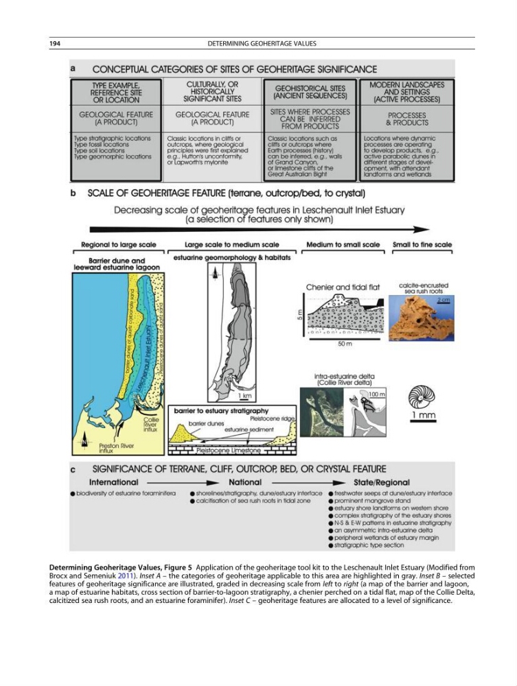
Determining Geoheritage Values, Figure 5 Application of the geoheritage tool kit to the Leschenault Inlet Estuary (Modified from
Brocx and Semeniuk 2011). Inset A – the categories of geoheritage applicable to this area are highlighted in gray. Inset B – selected
features of geoheritage significance are illustrated, graded in decreasing scale from left to right (a map of the barrier and lagoon,
a map of estuarine habitats, cross section of barrier-to-lagoon stratigraphy, a chenier perched on a tidal flat, map of the Collie Delta,
calcitized sea rush roots, and an estuarine foraminifer). Inset C – geoheritage features are allocated to a level of significance.
194
DETERMINING GEOHERITAGE VALUES
Brocx and Semeniuk 2011). Inset A – the categories of geoheritage applicable to this area are highlighted in gray. Inset B – selected
features of geoheritage significance are illustrated, graded in decreasing scale from left to right (a map of the barrier and lagoon,
a map of estuarine habitats, cross section of barrier-to-lagoon stratigraphy, a chenier perched on a tidal flat, map of the Collie Delta,
calcitized sea rush roots, and an estuarine foraminifer). Inset C – geoheritage features are allocated to a level of significance.
194
DETERMINING GEOHERITAGE VALUES