

5
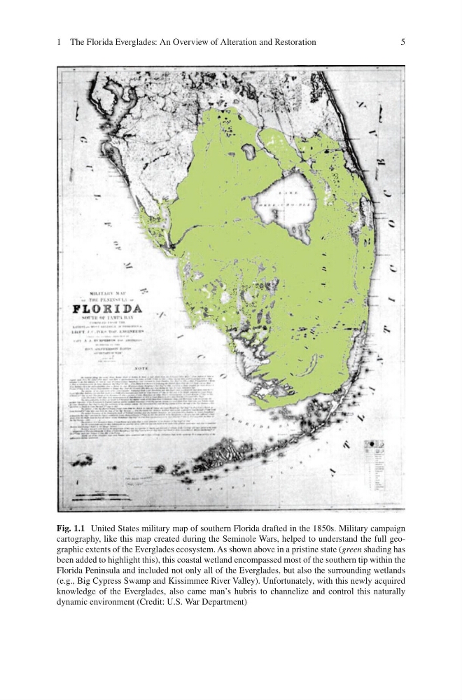
Fig. 1.1 United States military map of southern Florida drafted in the 1850s. Military campaign
cartography, like this map created during the Seminole Wars, helped to understand the full geographic extents of the Everglades ecosystem. As shown above in a pristine state (green shading has
been added to highlight this), this coastal wetland encompassed most of the southern tip within the
Florida Peninsula and included not only all of the Everglades, but also the surrounding wetlands
(e.g., Big Cypress Swamp and Kissimmee River Valley). Unfortunately, with this newly acquired
knowledge of the Everglades, also came man’s hubris to channelize and control this naturally
dynamic environment (Credit: U.S. War Department)
1 The Florida Everglades: An Overview of Alteration and Restoration
Fig. 1.1 United States military map of southern Florida drafted in the 1850s. Military campaign
cartography, like this map created during the Seminole Wars, helped to understand the full geographic extents of the Everglades ecosystem. As shown above in a pristine state (green shading has
been added to highlight this), this coastal wetland encompassed most of the southern tip within the
Florida Peninsula and included not only all of the Everglades, but also the surrounding wetlands
(e.g., Big Cypress Swamp and Kissimmee River Valley). Unfortunately, with this newly acquired
knowledge of the Everglades, also came man’s hubris to channelize and control this naturally
dynamic environment (Credit: U.S. War Department)
1 The Florida Everglades: An Overview of Alteration and Restoration