

238
Jeffery P. Holland et al.
Life-Cycle
Integrated
Modeling
Typical Site
Characterization
Assessment
Cleanup
Alternatives
Cleanup Optimization
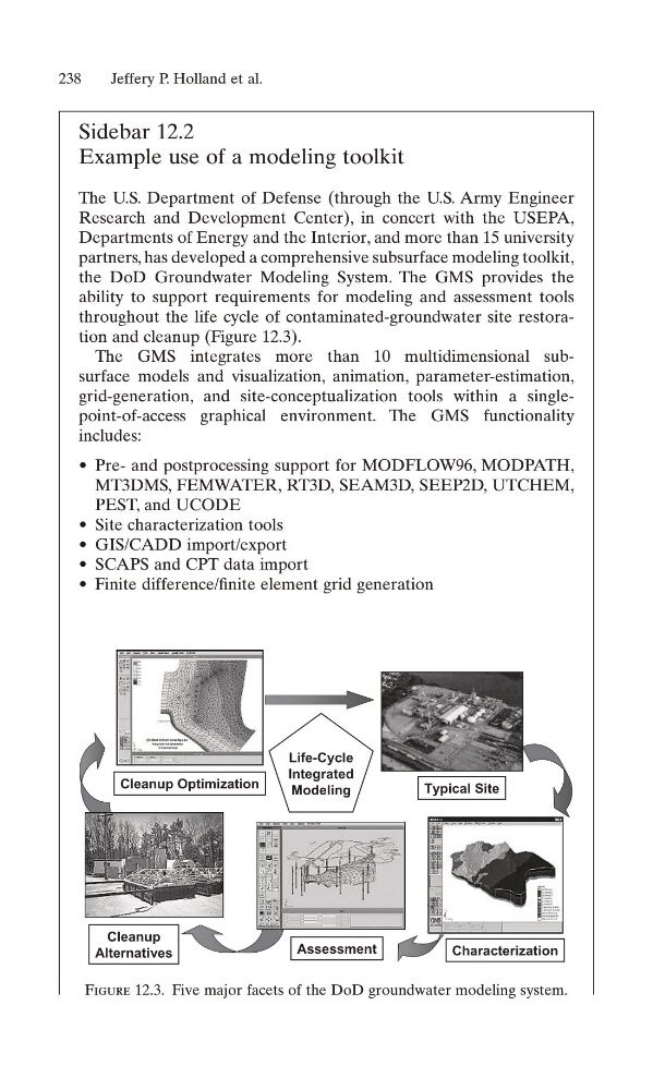
Figure 12.3. Five major facets of the DoD groundwater modeling system.
Sidebar 12.2
Example use of a modeling toolkit
The U.S. Department of Defense (through the U.S. Army Engineer
Research and Development Center), in concert with the USEPA,
Departments of Energy and the Interior, and more than 15 university
partners, has developed a comprehensive subsurface modeling toolkit,
the DoD Groundwater Modeling System. The GMS provides the
ability to support requirements for modeling and assessment tools
throughout the life cycle of contaminated-groundwater site restoration and cleanup (Figure 12.3).
The GMS integrates more than 10 multidimensional subsurface models and visualization, animation, parameter-estimation,
grid-generation, and site-conceptualization tools within a singlepoint-of-access graphical environment. The GMS functionality
includes:
• Pre- and postprocessing support for MODFLOW96, MODPATH,
MT3DMS, FEMWATER, RT3D, SEAM3D, SEEP2D, UTCHEM,
PEST, and UCODE
• Site characterization tools
• GIS/CADD import/export
• SCAPS and CPT data import
• Finite difference/finite element grid generation
Jeffery P. Holland et al.
Life-Cycle
Integrated
Modeling
Typical Site
Characterization
Assessment
Cleanup
Alternatives
Cleanup Optimization
Figure 12.3. Five major facets of the DoD groundwater modeling system.
Sidebar 12.2
Example use of a modeling toolkit
The U.S. Department of Defense (through the U.S. Army Engineer
Research and Development Center), in concert with the USEPA,
Departments of Energy and the Interior, and more than 15 university
partners, has developed a comprehensive subsurface modeling toolkit,
the DoD Groundwater Modeling System. The GMS provides the
ability to support requirements for modeling and assessment tools
throughout the life cycle of contaminated-groundwater site restoration and cleanup (Figure 12.3).
The GMS integrates more than 10 multidimensional subsurface models and visualization, animation, parameter-estimation,
grid-generation, and site-conceptualization tools within a singlepoint-of-access graphical environment. The GMS functionality
includes:
• Pre- and postprocessing support for MODFLOW96, MODPATH,
MT3DMS, FEMWATER, RT3D, SEAM3D, SEEP2D, UTCHEM,
PEST, and UCODE
• Site characterization tools
• GIS/CADD import/export
• SCAPS and CPT data import
• Finite difference/finite element grid generation