

134
48"40'
[ ; SAND
-
CLAYISH SAND
Ll Sll TY SAND
-
SANDYSILT
-CLAY
P. Lana et al.
N
.ct,
-
d
KM
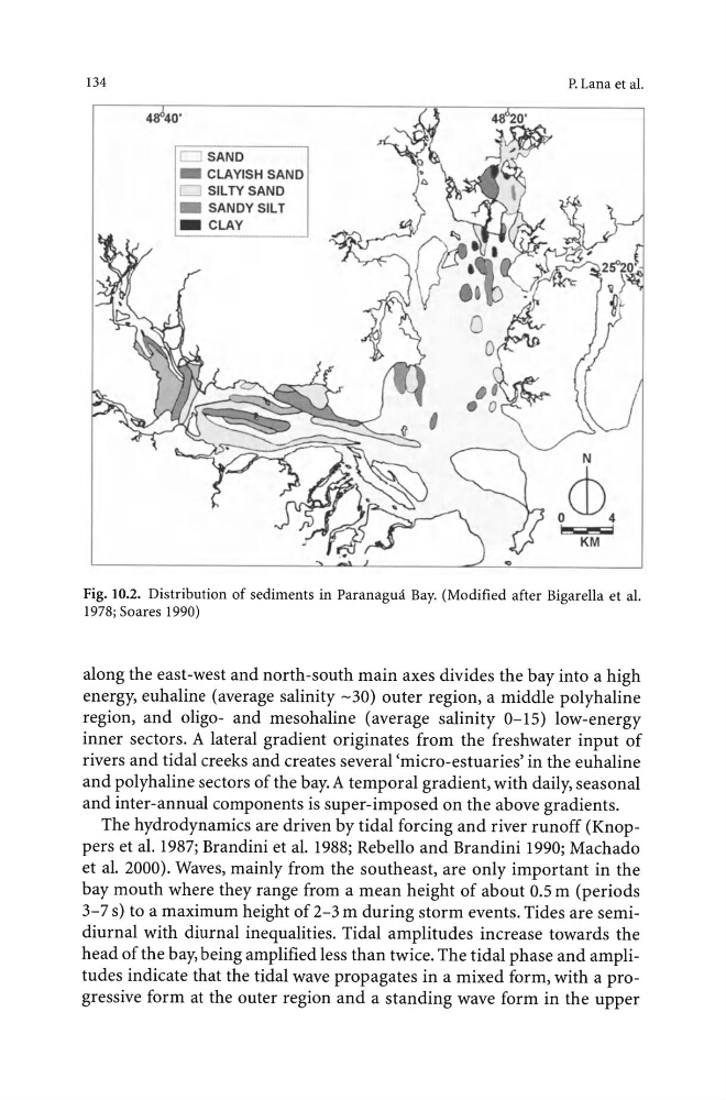
Fig. 10.2. Distribution of sediments in Paranagua Bay. (Modified after Bigarella et al.
1978; Soares 1990)
along the east-west and north-south main axes divides the bay into a high
energy, euhaline (average salinity -30) outer region, a middle polyhaline
region, and oligo- and mesohaline (average salinity 0- 15) low-energy
inner sectors. A lateral gradient originates from the freshwater input of
rivers and tidal creeks and creates several 'micro-estuaries' in the euhaline
and polyhaline sectors of the bay. A temporal gradient, with daily, seasonal
and inter-annual components is super-imposed on the above gradients.
The hydrodynamics are driven by tidal forcing and river runoff (Knoppers et al. 1987; Brandini et al. 1988; Rebello and Brandini 1990; Machado
et al. 2000). Waves, mainly from the southeast, are only important in the
bay mouth where they range from a mean height of about 0.5 m (periods
3-7 s) to a maximum height of 2-3m during storm events. Tides are semidiurnal with diurnal inequalities. Tidal amplitudes increase towards the
head of the bay, being amplified less than twice. The tidal phase and amplitudes indicate that the tidal wave propagates in a mixed form, with a progressive form at the outer region and a standing wave form in the upper
48"40'
[ ; SAND
-
CLAYISH SAND
Ll Sll TY SAND
-
SANDYSILT
-CLAY
P. Lana et al.
N
.ct,
-
d
KM
Fig. 10.2. Distribution of sediments in Paranagua Bay. (Modified after Bigarella et al.
1978; Soares 1990)
along the east-west and north-south main axes divides the bay into a high
energy, euhaline (average salinity -30) outer region, a middle polyhaline
region, and oligo- and mesohaline (average salinity 0- 15) low-energy
inner sectors. A lateral gradient originates from the freshwater input of
rivers and tidal creeks and creates several 'micro-estuaries' in the euhaline
and polyhaline sectors of the bay. A temporal gradient, with daily, seasonal
and inter-annual components is super-imposed on the above gradients.
The hydrodynamics are driven by tidal forcing and river runoff (Knoppers et al. 1987; Brandini et al. 1988; Rebello and Brandini 1990; Machado
et al. 2000). Waves, mainly from the southeast, are only important in the
bay mouth where they range from a mean height of about 0.5 m (periods
3-7 s) to a maximum height of 2-3m during storm events. Tides are semidiurnal with diurnal inequalities. Tidal amplitudes increase towards the
head of the bay, being amplified less than twice. The tidal phase and amplitudes indicate that the tidal wave propagates in a mixed form, with a progressive form at the outer region and a standing wave form in the upper