

108
DUQUE
DE CAXIAS
ATLANTIC OC EAN
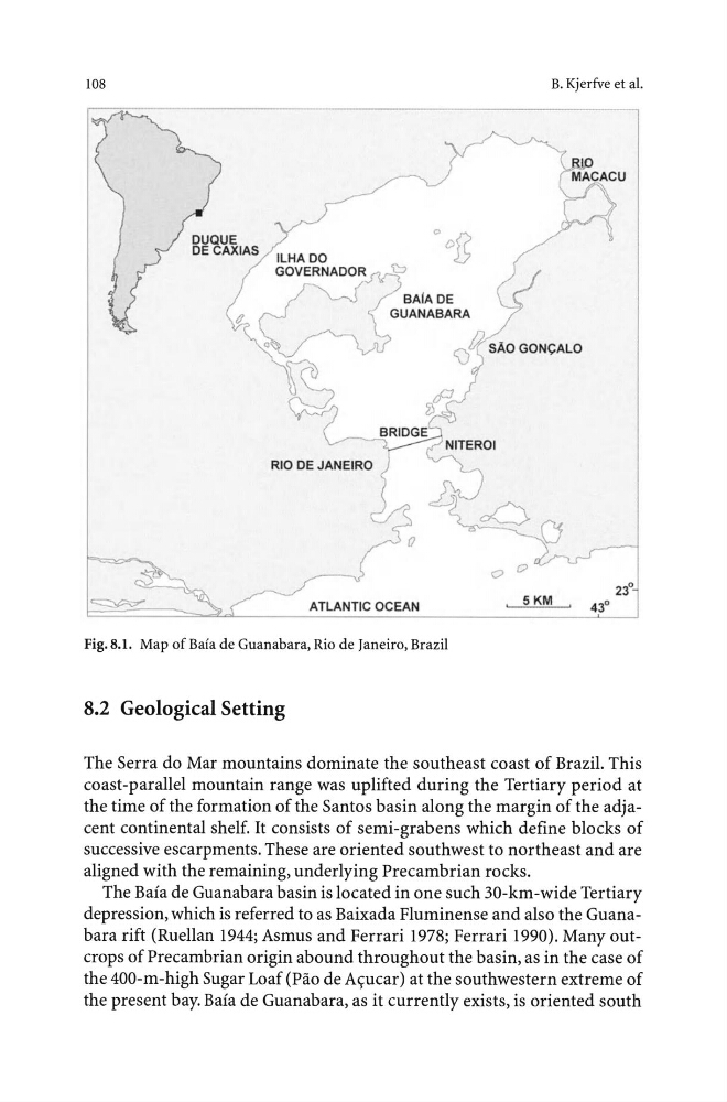
Fig. 8.1. Map of Bafa de Guanabara, Rio de Janeiro, Brazil
8.2 Geological Setting
B. Kjerfve eta!.
0
0
5KM
The Serra do Mar mountains dominate the southeast coast of Brazil. This
coast-parallel mountain range was uplifted during the Tertiary period at
the time of the formation of the Santos basin along the margin of the adjacent continental shelf. It consists of semi-grabens which define blocks of
successive escarpments. These are oriented southwest to northeast and are
aligned with the remaining, underlying Precambrian rocks.
The Baia de Guanabara basin is located in one such 30-km-wide Tertiary
depression, which is referred to as Baixada Fluminense and also the Guanabara rift (Ruellan 1944; Asmus and Ferrari 1978; Ferrari 1990). Many outcrops of Precambrian origin abound throughout the basin, as in the case of
the 400-m-high Sugar Loaf (Pao de A<;:ucar) at the southwestern extreme of
the present bay. Baia de Guanabara, as it currently exists, is oriented south
DUQUE
DE CAXIAS
ATLANTIC OC EAN
Fig. 8.1. Map of Bafa de Guanabara, Rio de Janeiro, Brazil
8.2 Geological Setting
B. Kjerfve eta!.
0
0
5KM
The Serra do Mar mountains dominate the southeast coast of Brazil. This
coast-parallel mountain range was uplifted during the Tertiary period at
the time of the formation of the Santos basin along the margin of the adjacent continental shelf. It consists of semi-grabens which define blocks of
successive escarpments. These are oriented southwest to northeast and are
aligned with the remaining, underlying Precambrian rocks.
The Baia de Guanabara basin is located in one such 30-km-wide Tertiary
depression, which is referred to as Baixada Fluminense and also the Guanabara rift (Ruellan 1944; Asmus and Ferrari 1978; Ferrari 1990). Many outcrops of Precambrian origin abound throughout the basin, as in the case of
the 400-m-high Sugar Loaf (Pao de A<;:ucar) at the southwestern extreme of
the present bay. Baia de Guanabara, as it currently exists, is oriented south