

Model Simulation of Temporal Variability of Suspended
Matter in the North Sea
w. PuIs, T. Pohlmann and J. Siindermann
1
Introduction
The North Sea is a shelf sea with maximum water depths of 50 m in its southern
half and between 50 and 120 m in its northern half. Special geographic features
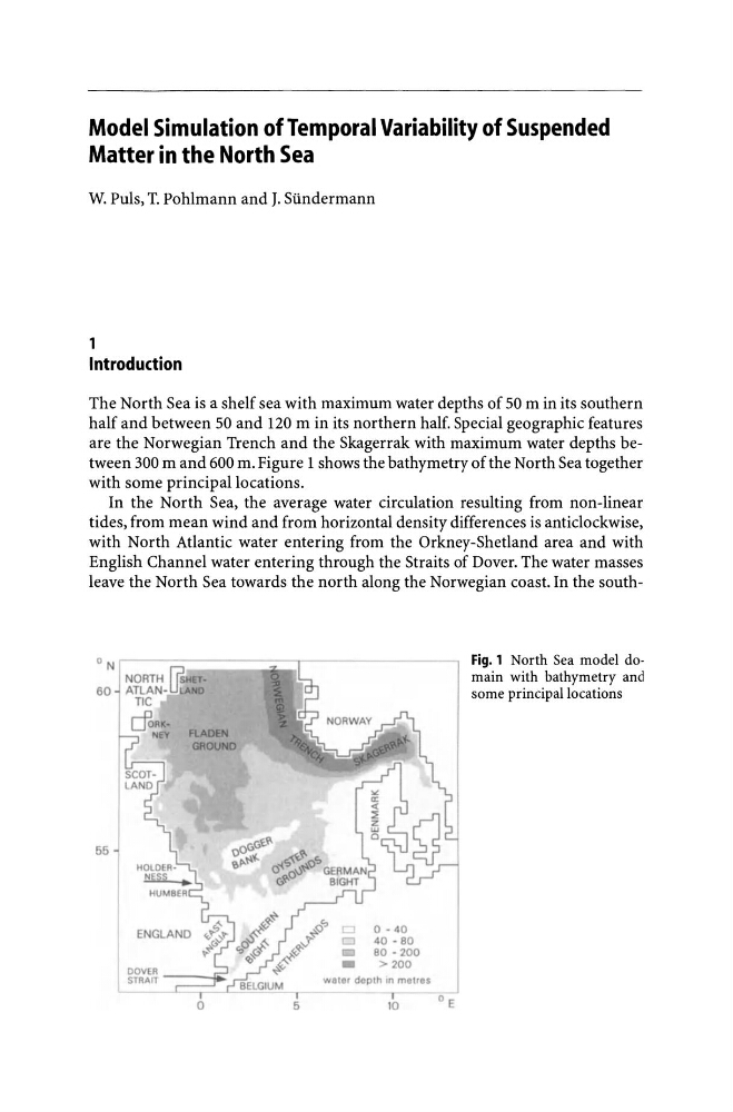
are the Norwegian Trench and the Skagerrak with maximum water depths between 300 m and 600 m. Figure 1 shows the bathymetry of the North Sea together
with some principal locations.
In the North Sea, the average water circulation resulting from non-linear
tides, from mean wind and from horizontal density differences is anticlockwise,
with North Atlantic water entering from the Orkney-Shetland area and with
English Channel water entering through the Straits of Dover. The water masses
leave the North Sea towards the north along the Norwegian coast. In the southON
NORTH r?sHET.
60 ATLAN-U~AND
TIC
55
o
I
5
0-40
r::J
40 - 80
_
80 - 200
_
>200
water depth In metres
I
10
o E
Fig. 1 North Sea model domain with bathymetry and
some principal locations
Matter in the North Sea
w. PuIs, T. Pohlmann and J. Siindermann
1
Introduction
The North Sea is a shelf sea with maximum water depths of 50 m in its southern
half and between 50 and 120 m in its northern half. Special geographic features
are the Norwegian Trench and the Skagerrak with maximum water depths between 300 m and 600 m. Figure 1 shows the bathymetry of the North Sea together
with some principal locations.
In the North Sea, the average water circulation resulting from non-linear
tides, from mean wind and from horizontal density differences is anticlockwise,
with North Atlantic water entering from the Orkney-Shetland area and with
English Channel water entering through the Straits of Dover. The water masses
leave the North Sea towards the north along the Norwegian coast. In the southON
NORTH r?sHET.
60 ATLAN-U~AND
TIC
55
o
I
5
0-40
r::J
40 - 80
_
80 - 200
_
>200
water depth In metres
I
10
o E
Fig. 1 North Sea model domain with bathymetry and
some principal locations