

Methods Used in a Mass-Balance Study of Holocene Sediment Accumulation on the ...
., .
. .
. ,
bw_
-...
lIiIIJ ~
CJ ::""l
~ rtWWlttlDl::nD.""
~ (HON~.
" " " < 1 0 _
1HON1II
--. . -
{HVNn'lbf
....... -
[HUN lsI
'o"DikNo tIlM)w N~ nor filJld
WI.rtr~DfWiir«
~ (\J'II)
363
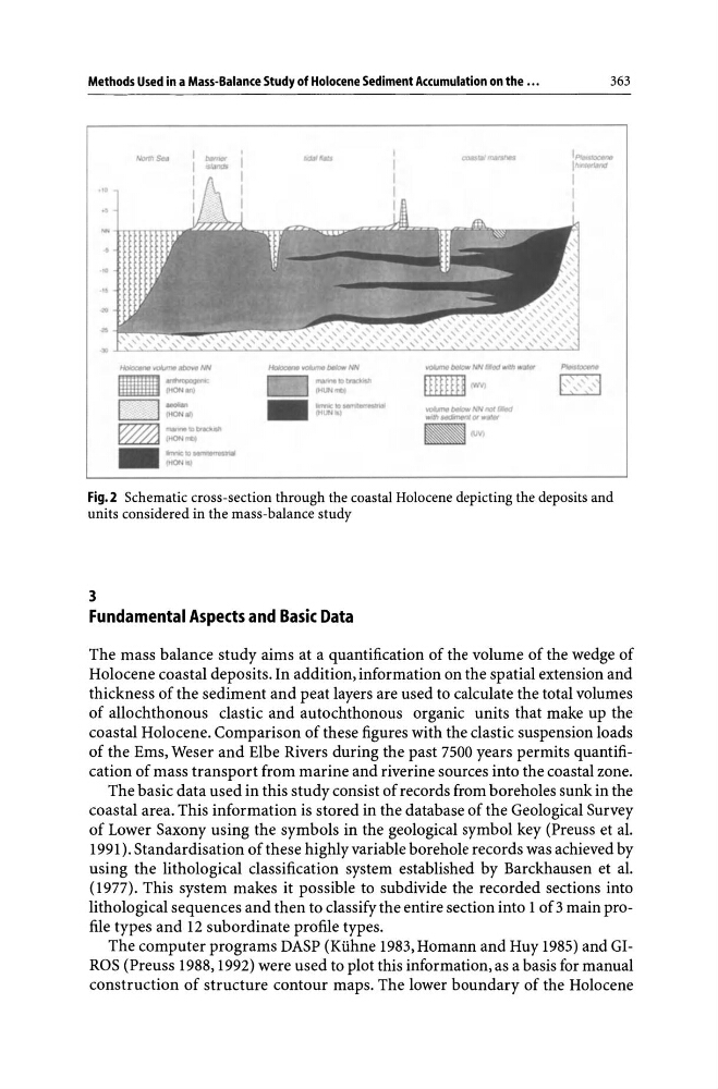
Fig.2 Schematic cross-section through the coastal Holocene depicting the deposits and
units considered in the mass-balance study
3
Fundamental Aspects and Basic Data
The mass balance study aims at a quantification of the volume of the wedge of
Holocene coastal deposits. In addition, information on the spatial extension and
thickness of the sediment and peat layers are used to calculate the total volumes
of allochthonous clastic and autochthonous organic units that make up the
coastal Holocene. Comparison of these figures with the clastic suspension loads
of the Ems, Weser and Elbe Rivers during the past 7500 years permits quantification of mass transport from marine and riverine sources into the coastal zone.
The basic data used in this study consist of records from boreholes sunk in the
coastal area. This information is stored in the database of the Geological Survey
of Lower Saxony using the symbols in the geological symbol key (Preuss et al.
1991). Standardisation of these highly variable borehole records was achieved by
using the lithological classification system established by Barckhausen et al.
(1977). This system makes it possible to subdivide the recorded sections into
lithological sequences and then to classify the entire section into 1 of 3 main profile types and 12 subordinate profile types.
The computer programs DASP (Kuhne 1983, Homann and Huy 1985) and GIROS (Preuss 1988,1992) were used to plot this information, as a basis for manual
construction of structure contour maps. The lower boundary of the Holocene
., .
. .
. ,
bw_
-...
lIiIIJ ~
CJ ::""l
~ rtWWlttlDl::nD.""
~ (HON~.
" " " < 1 0 _
1HON1II
--. . -
{HVNn'lbf
....... -
[HUN lsI
'o"DikNo tIlM)w N~ nor filJld
WI.rtr~DfWiir«
~ (\J'II)
363
Fig.2 Schematic cross-section through the coastal Holocene depicting the deposits and
units considered in the mass-balance study
3
Fundamental Aspects and Basic Data
The mass balance study aims at a quantification of the volume of the wedge of
Holocene coastal deposits. In addition, information on the spatial extension and
thickness of the sediment and peat layers are used to calculate the total volumes
of allochthonous clastic and autochthonous organic units that make up the
coastal Holocene. Comparison of these figures with the clastic suspension loads
of the Ems, Weser and Elbe Rivers during the past 7500 years permits quantification of mass transport from marine and riverine sources into the coastal zone.
The basic data used in this study consist of records from boreholes sunk in the
coastal area. This information is stored in the database of the Geological Survey
of Lower Saxony using the symbols in the geological symbol key (Preuss et al.
1991). Standardisation of these highly variable borehole records was achieved by
using the lithological classification system established by Barckhausen et al.
(1977). This system makes it possible to subdivide the recorded sections into
lithological sequences and then to classify the entire section into 1 of 3 main profile types and 12 subordinate profile types.
The computer programs DASP (Kuhne 1983, Homann and Huy 1985) and GIROS (Preuss 1988,1992) were used to plot this information, as a basis for manual
construction of structure contour maps. The lower boundary of the Holocene