

Digital Database of Modern Evaporites and their Predicted Distribution Based on Results...
161
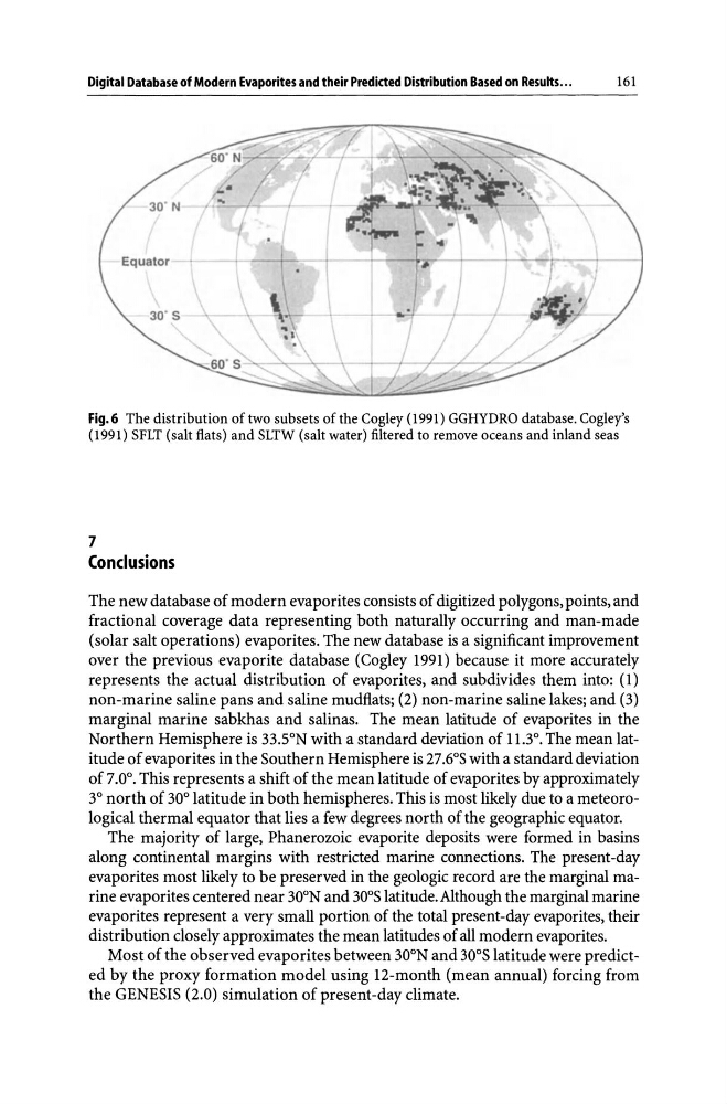
Fig.6 The distribution of two subsets of the Cogley (1991) GGHYDRO database. Cogley's
(1991) SFLT (salt flats) and SLTW (salt water) filtered to remove oceans and inland seas
7
Conclusions
The new database of modern evaporites consists of digitized polygons, points, and
fractional coverage data representing both naturally occurring and man-made
(solar salt operations) evaporites. The new database is a significant improvement
over the previous evaporite database (Cogley 1991) because it more accurately
represents the actual distribution of evaporites, and subdivides them into: (1)
non-marine saline pans and saline mudflats; (2) non-marine saline lakes; and (3)
marginal marine sabkhas and salinas. The mean latitude of evaporites in the
Northern Hemisphere is 33SN with a standard deviation of 11.3°. The mean latitude of evaporites in the Southern Hemisphere is 27.6°S with a standard deviation
of 7.0°. This represents a shift of the mean latitude of evaporites by approximately
3° north of 30° latitude in both hemispheres. This is most likely due to a meteorological thermal equator that lies a few degrees north of the geographic equator.
The majority of large, Phanerozoic evaporite deposits were formed in basins
along continental margins with restricted marine connections. The present-day
evaporites most likely to be preserved in the geologic record are the marginal marine evaporites centered near 30 0 N and 30 0 S latitude. Although the marginal marine
evaporites represent a very small portion of the total present-day evaporites, their
distribution closely approximates the mean latitudes of all modern evaporites.
Most of the observed evaporites between 30 0 N and 30 0 S latitude were predicted by the proxy formation model using 12-month (mean annual) forcing from
the GENESIS (2.0) simulation of present-day climate.
161
Fig.6 The distribution of two subsets of the Cogley (1991) GGHYDRO database. Cogley's
(1991) SFLT (salt flats) and SLTW (salt water) filtered to remove oceans and inland seas
7
Conclusions
The new database of modern evaporites consists of digitized polygons, points, and
fractional coverage data representing both naturally occurring and man-made
(solar salt operations) evaporites. The new database is a significant improvement
over the previous evaporite database (Cogley 1991) because it more accurately
represents the actual distribution of evaporites, and subdivides them into: (1)
non-marine saline pans and saline mudflats; (2) non-marine saline lakes; and (3)
marginal marine sabkhas and salinas. The mean latitude of evaporites in the
Northern Hemisphere is 33SN with a standard deviation of 11.3°. The mean latitude of evaporites in the Southern Hemisphere is 27.6°S with a standard deviation
of 7.0°. This represents a shift of the mean latitude of evaporites by approximately
3° north of 30° latitude in both hemispheres. This is most likely due to a meteorological thermal equator that lies a few degrees north of the geographic equator.
The majority of large, Phanerozoic evaporite deposits were formed in basins
along continental margins with restricted marine connections. The present-day
evaporites most likely to be preserved in the geologic record are the marginal marine evaporites centered near 30 0 N and 30 0 S latitude. Although the marginal marine
evaporites represent a very small portion of the total present-day evaporites, their
distribution closely approximates the mean latitudes of all modern evaporites.
Most of the observed evaporites between 30 0 N and 30 0 S latitude were predicted by the proxy formation model using 12-month (mean annual) forcing from
the GENESIS (2.0) simulation of present-day climate.