

236
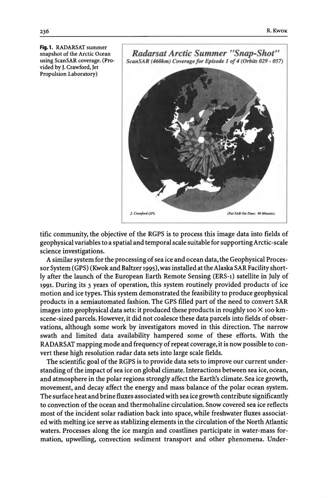
Fig.l. RADARSAT summer
snapshot of the Arctic Ocean
using ScanSAR coverage. (Provided by J. Crawford, Jet
Propulsion Laboratory)
R.KwOK
Radarsat Arctic Summer "Snap-Shot"
ScanSAR (460km) Co~erage/or Episode J 0/4 (Orbits 029 - 057)
tific community, the objective of the RGPS is to process this image data into fields of
geophysical variables to a spatial and temporal scale suitable for supporting Arctic-scale
science investigations.
A similar system for the processing of sea ice and ocean data, the Geophysical Processor System (GPS) (Kwok and Baltzer 1995), was installed at the Alaska SAR Facility shortly after the launch of the European Earth Remote Sensing (ERS-1) satellite in July of
1991. During its 3 years of operation, this system routinely provided products of ice
motion and ice types. This system demonstrated the feasibility to produce geophysical
products in a semiautomated fashion. The GPS filled part of the need to convert SAR
images into geophysical data sets: it produced these products in roughly 100 X 100 kmscene-sized parcels. However, it did not coalesce these data parcels into fields of observations, although some work by investigators moved in this direction. The narrow
swath and limited data availability hampered some of these efforts. With the
RADARSAT mapping mode and frequency of repeat coverage, it is now possible to convert these high resolution radar data sets into large scale fields.
The scientific goal of the RGPS is to provide data sets to improve our current understanding of the impact of sea ice on global climate. Interactions between sea ice, ocean,
and atmosphere in the polar regions strongly affect the Earth's climate. Sea ice growth,
movement, and decay affect the energy and mass balance of the polar ocean system.
The surface heat and brine fluxes associated with sea ice growth contribute significantly
to convection of the ocean and thermohaline circulation. Snow covered sea ice reflects
most of the incident solar radiation back into space, while freshwater fluxes associated with melting ice serve as stablizing elements in the circulation of the North Atlantic
waters. Processes along the ice margin and coastlines participate in water-mass formation, upwelling, convection sediment transport and other phenomena. Under-
Fig.l. RADARSAT summer
snapshot of the Arctic Ocean
using ScanSAR coverage. (Provided by J. Crawford, Jet
Propulsion Laboratory)
R.KwOK
Radarsat Arctic Summer "Snap-Shot"
ScanSAR (460km) Co~erage/or Episode J 0/4 (Orbits 029 - 057)
tific community, the objective of the RGPS is to process this image data into fields of
geophysical variables to a spatial and temporal scale suitable for supporting Arctic-scale
science investigations.
A similar system for the processing of sea ice and ocean data, the Geophysical Processor System (GPS) (Kwok and Baltzer 1995), was installed at the Alaska SAR Facility shortly after the launch of the European Earth Remote Sensing (ERS-1) satellite in July of
1991. During its 3 years of operation, this system routinely provided products of ice
motion and ice types. This system demonstrated the feasibility to produce geophysical
products in a semiautomated fashion. The GPS filled part of the need to convert SAR
images into geophysical data sets: it produced these products in roughly 100 X 100 kmscene-sized parcels. However, it did not coalesce these data parcels into fields of observations, although some work by investigators moved in this direction. The narrow
swath and limited data availability hampered some of these efforts. With the
RADARSAT mapping mode and frequency of repeat coverage, it is now possible to convert these high resolution radar data sets into large scale fields.
The scientific goal of the RGPS is to provide data sets to improve our current understanding of the impact of sea ice on global climate. Interactions between sea ice, ocean,
and atmosphere in the polar regions strongly affect the Earth's climate. Sea ice growth,
movement, and decay affect the energy and mass balance of the polar ocean system.
The surface heat and brine fluxes associated with sea ice growth contribute significantly
to convection of the ocean and thermohaline circulation. Snow covered sea ice reflects
most of the incident solar radiation back into space, while freshwater fluxes associated with melting ice serve as stablizing elements in the circulation of the North Atlantic
waters. Processes along the ice margin and coastlines participate in water-mass formation, upwelling, convection sediment transport and other phenomena. Under-