

6 Wavelet Analysis of SAR Images in the Marginal Ice Zone
119
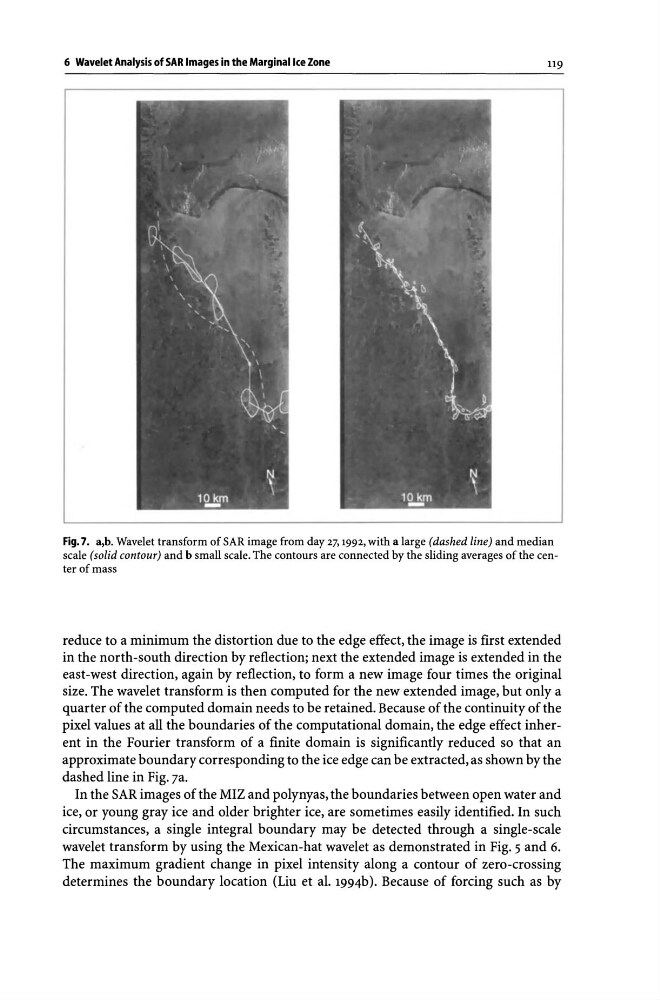
Fig. 7. a,b. Wavelet transform of SAR image from day 27, 1992, with a large (dashed line) and median
scale (solid contour) and b small scale. The contours are connected by the sliding averages of the center of mass
reduce to a minimum the distortion due to the edge effect, the image is first extended
in the north-south direction by reflection; next the extended image is extended in the
east-west direction, again by reflection, to form a new image four times the original
size. The wavelet transform is then computed for the new extended image, but only a
quarter of the computed domain needs to be retained. Because of the continuity of the
pixel values at all the boundaries of the computational domain, the edge effect inherent in the Fourier transform of a finite domain is significantly reduced so that an
approximate boundary corresponding to the ice edge can be extracted, as shown by the
dashed line in Fig. 7a.
In the SAR images of the MIZ and polynyas, the boundaries between open water and
ice, or young gray ice and older brighter ice, are sometimes easily identified. In such
circumstances, a single integral boundary may be detected through a single-scale
wavelet transform by using the Mexican-hat wavelet as demonstrated in Fig. 5 and 6.
The maximum gradient change in pixel intensity along a contour of zero-crossing
determines the boundary location (Liu et al. 1994b). Because of forcing such as by
119
Fig. 7. a,b. Wavelet transform of SAR image from day 27, 1992, with a large (dashed line) and median
scale (solid contour) and b small scale. The contours are connected by the sliding averages of the center of mass
reduce to a minimum the distortion due to the edge effect, the image is first extended
in the north-south direction by reflection; next the extended image is extended in the
east-west direction, again by reflection, to form a new image four times the original
size. The wavelet transform is then computed for the new extended image, but only a
quarter of the computed domain needs to be retained. Because of the continuity of the
pixel values at all the boundaries of the computational domain, the edge effect inherent in the Fourier transform of a finite domain is significantly reduced so that an
approximate boundary corresponding to the ice edge can be extracted, as shown by the
dashed line in Fig. 7a.
In the SAR images of the MIZ and polynyas, the boundaries between open water and
ice, or young gray ice and older brighter ice, are sometimes easily identified. In such
circumstances, a single integral boundary may be detected through a single-scale
wavelet transform by using the Mexican-hat wavelet as demonstrated in Fig. 5 and 6.
The maximum gradient change in pixel intensity along a contour of zero-crossing
determines the boundary location (Liu et al. 1994b). Because of forcing such as by