

520
BRUCE HACKETT ET AL.
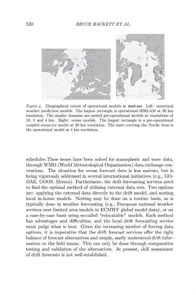
Figure 4. Geographical extent of operational models at met.no. Left: numerical
weather prediction models. The largest rectangle is operational HIRLAM at 20 km
resolution. The smaller domains are nested pre-operational models at resolutions of
10, 5 and 4 km. Right: ocean models. The largest rectangle is a pre-operational
coupled ocean-ice model at 20 km resolution. The inset covering the Nordic Seas is
the operational model at 4 km resolution.
through WMO (World Meteorological Organization) data exchange conventions. The situation for ocean forecast data is less mature, but is
being vigorously addressed in several international initiatives (e.g., GODAE, GOOS, Mersea). Furthermore, the drift forecasting services need
to find the optimal method of utilizing external data sets. Two options
are: applying the external data directly to the drift model, and nesting
local in-house models. Nesting may be done on a routine basis, as is
typically done in weather forecasting (e.g., European national weather
services nest limited area models in ECMWF global model data), or on
a case-by-case basis using so-called “relocatable” models. Each method
has advantages and difficulties, and the local drift forecasting service
must judge what is best. Given the increasing number of forcing data
options, it is imperative that the drift forecast services offer the right
balance of forecast alternatives and simple, easily understood drift information to the field teams. This can only be done through comparative
testing and validation of the alternatives. At present, skill assessment
of drift forecasts is not well-established.
schedules. These issues have been solved for atmospheric and wave data,
BRUCE HACKETT ET AL.
Figure 4. Geographical extent of operational models at met.no. Left: numerical
weather prediction models. The largest rectangle is operational HIRLAM at 20 km
resolution. The smaller domains are nested pre-operational models at resolutions of
10, 5 and 4 km. Right: ocean models. The largest rectangle is a pre-operational
coupled ocean-ice model at 20 km resolution. The inset covering the Nordic Seas is
the operational model at 4 km resolution.
through WMO (World Meteorological Organization) data exchange conventions. The situation for ocean forecast data is less mature, but is
being vigorously addressed in several international initiatives (e.g., GODAE, GOOS, Mersea). Furthermore, the drift forecasting services need
to find the optimal method of utilizing external data sets. Two options
are: applying the external data directly to the drift model, and nesting
local in-house models. Nesting may be done on a routine basis, as is
typically done in weather forecasting (e.g., European national weather
services nest limited area models in ECMWF global model data), or on
a case-by-case basis using so-called “relocatable” models. Each method
has advantages and difficulties, and the local drift forecasting service
must judge what is best. Given the increasing number of forcing data
options, it is imperative that the drift forecast services offer the right
balance of forecast alternatives and simple, easily understood drift information to the field teams. This can only be done through comparative
testing and validation of the alternatives. At present, skill assessment
of drift forecasts is not well-established.
schedules. These issues have been solved for atmospheric and wave data,