

160
IAN ROBINSON
each other’s orbits tracks it is possible, over an extended time span, to
significantly improve their orbit definitions by cross-referencing to the better
known T/P or Jason orbits. The accuracy quoted for the SSHA applies only
after this procedure has been performed, and would otherwise be much
worse for the ERS and Geosat families. The specification of errors for an
altimeter must be handled with care because the error magnitude relates very
much to the time and space scale over which it is being averaged. The lower
error attached to larger-scale / longer-period averaging must be offset against
the lesser utility of the averaged SSHA field, especially in the context of
operational oceanography.
3.1.3
Variable currents from sea surface height anomaly
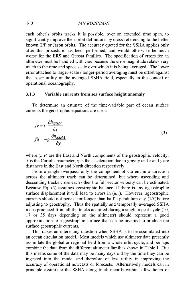
To determine an estimate of the time-variable part of ocean surface
currents the geostrophic equations are used:
y
h
g
fu
x
h
g
fv
SSHA
SSHA
w
w
w
w
(3)
f
distances in the East and North direction respectively.
From a single overpass, only the component of current in a direction
across the altimeter track can be determined, but where ascending and
descending tracks cross each other the full vector velocity can be estimated.
Because Eq. (3) assumes geostrophic balance, if there is any ageostrophic
surface displacement it will lead to errors in (u,v). However, ageostrophic
currents should not persist for longer than half a pendulum day (1/f ) before
adjusting to geostrophy. Thus the spatially and temporally averaged SSHA
maps produced from all the tracks acquired during a single repeat cycle (10,
17 or 35 days depending on the altimeter) should represent a good
approximation to a geostrophic surface that can be inverted to produce the
surface geostrophic currents.
This raises an interesting question when SSHA is to be assimilated into
an ocean circulation model. Most models which use altimeter data presently
assimilate the global or regional field from a whole orbit cycle, and perhaps
combine the data from the different altimeter families shown in Table 1. But
this means some of the data may be many days old by the time they can be
ingested into the model and therefore of less utility in improving the
accuracy of operational nowcasts or forecasts. Alternatively models can in
principle assimilate the SSHA along track records within a few hours of
is the Coriolis parameter, g is the acceleration due to gravity and x and y are
where (u,v) are the East and North components of the geostrophic velocity,
IAN ROBINSON
each other’s orbits tracks it is possible, over an extended time span, to
significantly improve their orbit definitions by cross-referencing to the better
known T/P or Jason orbits. The accuracy quoted for the SSHA applies only
after this procedure has been performed, and would otherwise be much
worse for the ERS and Geosat families. The specification of errors for an
altimeter must be handled with care because the error magnitude relates very
much to the time and space scale over which it is being averaged. The lower
error attached to larger-scale / longer-period averaging must be offset against
the lesser utility of the averaged SSHA field, especially in the context of
operational oceanography.
3.1.3
Variable currents from sea surface height anomaly
To determine an estimate of the time-variable part of ocean surface
currents the geostrophic equations are used:
y
h
g
fu
x
h
g
fv
SSHA
SSHA
w
w
w
w
(3)
f
distances in the East and North direction respectively.
From a single overpass, only the component of current in a direction
across the altimeter track can be determined, but where ascending and
descending tracks cross each other the full vector velocity can be estimated.
Because Eq. (3) assumes geostrophic balance, if there is any ageostrophic
surface displacement it will lead to errors in (u,v). However, ageostrophic
currents should not persist for longer than half a pendulum day (1/f ) before
adjusting to geostrophy. Thus the spatially and temporally averaged SSHA
maps produced from all the tracks acquired during a single repeat cycle (10,
17 or 35 days depending on the altimeter) should represent a good
approximation to a geostrophic surface that can be inverted to produce the
surface geostrophic currents.
This raises an interesting question when SSHA is to be assimilated into
an ocean circulation model. Most models which use altimeter data presently
assimilate the global or regional field from a whole orbit cycle, and perhaps
combine the data from the different altimeter families shown in Table 1. But
this means some of the data may be many days old by the time they can be
ingested into the model and therefore of less utility in improving the
accuracy of operational nowcasts or forecasts. Alternatively models can in
principle assimilate the SSHA along track records within a few hours of
is the Coriolis parameter, g is the acceleration due to gravity and x and y are
where (u,v) are the East and North components of the geostrophic velocity,