

fine-grained devitrified cement with zeolite (SP08-03). At depths shallower than
1000 m, only mylonitized peridotites were seen.
In addition, our deep-towed television camera instrument (Scampi station # 05)
was lowered at night after my dive, at 22:00 on January 1,1998. This real time
video imaging indicated that outcrops of peridotite on the slope of the St. Paul’s
Rocks North Ridge extend down to depths of at least 3927 m near 01°00
N-29°21 W (Fig. 8.15a, b). Thus, the peridotite outcrops continue deeper than the
dives we made, which is to say, more than 4 km down the slope.
Origin of the St. Peter’s and St. Paul’s Rocks (SPPR)
Massif
The SPPR has an ‘‘S’’-like sigmoidal shape, due to the differential strike-slip
movements of the two transform faults’ walls, linking the two spreading ridges
(MAR and the ITR at 27°41
0 W) (Fig. 8.15a, b). Such a strike-slip motion generated a tear in the lithosphere which accommodated volcanism and a serpentinized
diapir on the South Ridge and as well as on the North Ridge. The strike-slip
motion of the main transform fault walls was affected by sheering and thrustfaulting tectonic events accompanied by an uplift of the North Ridge and the
emplacement of plastically deformed peridotite transformed into mylonite. This is
similar to what happens when you squeeze toothpaste out of its tube. Based on
geophysical data, bathymetric data and the field observations we obtained, the
sequences of formation of the SPPR massif seems to include two processes or
phases.
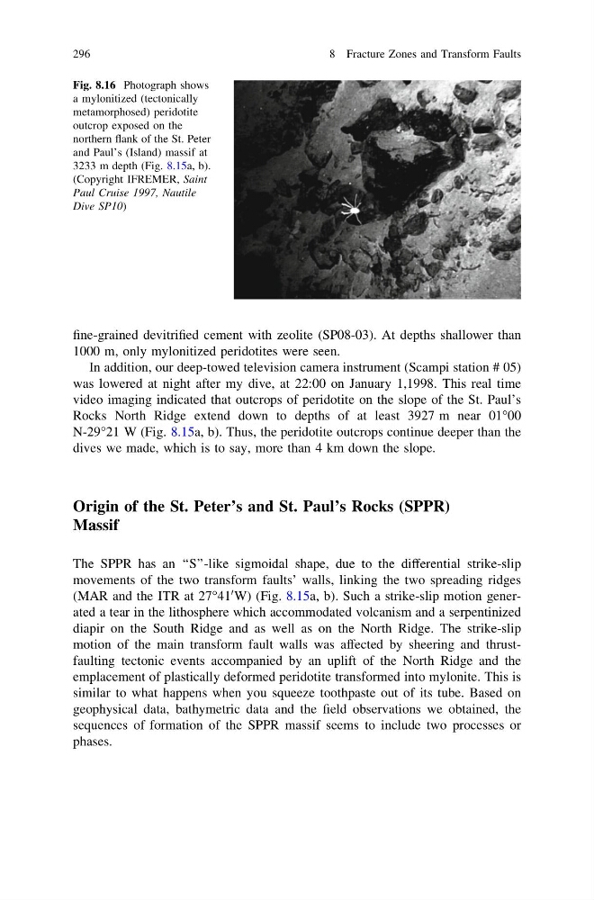
Fig. 8.16 Photograph shows
a mylonitized (tectonically
metamorphosed) peridotite
outcrop exposed on the
northern flank of the St. Peter
and Paul’s (Island) massif at
3233 m depth (Fig. 8.15a, b).
(Copyright IFREMER, Saint
Paul Cruise 1997, Nautile
Dive SP10)
296
8 Fracture Zones and Transform Faults
1000 m, only mylonitized peridotites were seen.
In addition, our deep-towed television camera instrument (Scampi station # 05)
was lowered at night after my dive, at 22:00 on January 1,1998. This real time
video imaging indicated that outcrops of peridotite on the slope of the St. Paul’s
Rocks North Ridge extend down to depths of at least 3927 m near 01°00
N-29°21 W (Fig. 8.15a, b). Thus, the peridotite outcrops continue deeper than the
dives we made, which is to say, more than 4 km down the slope.
Origin of the St. Peter’s and St. Paul’s Rocks (SPPR)
Massif
The SPPR has an ‘‘S’’-like sigmoidal shape, due to the differential strike-slip
movements of the two transform faults’ walls, linking the two spreading ridges
(MAR and the ITR at 27°41
0 W) (Fig. 8.15a, b). Such a strike-slip motion generated a tear in the lithosphere which accommodated volcanism and a serpentinized
diapir on the South Ridge and as well as on the North Ridge. The strike-slip
motion of the main transform fault walls was affected by sheering and thrustfaulting tectonic events accompanied by an uplift of the North Ridge and the
emplacement of plastically deformed peridotite transformed into mylonite. This is
similar to what happens when you squeeze toothpaste out of its tube. Based on
geophysical data, bathymetric data and the field observations we obtained, the
sequences of formation of the SPPR massif seems to include two processes or
phases.
Fig. 8.16 Photograph shows
a mylonitized (tectonically
metamorphosed) peridotite
outcrop exposed on the
northern flank of the St. Peter
and Paul’s (Island) massif at
3233 m depth (Fig. 8.15a, b).
(Copyright IFREMER, Saint
Paul Cruise 1997, Nautile
Dive SP10)
296
8 Fracture Zones and Transform Faults