

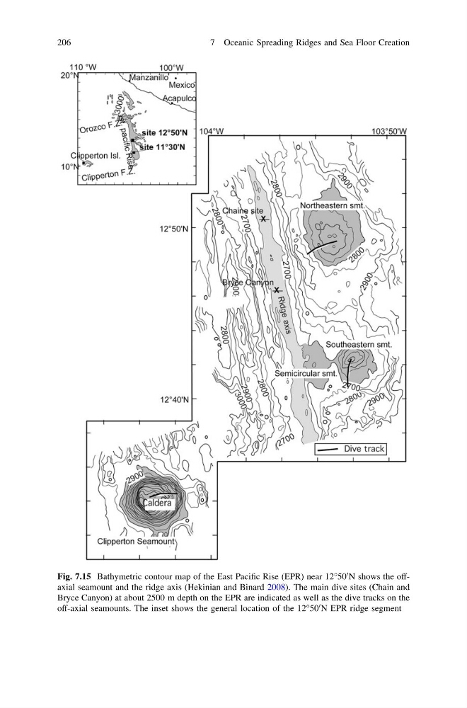
Fig. 7.15 Bathymetric contour map of the East Pacific Rise (EPR) near 12°50
0 N shows the offaxial seamount and the ridge axis (Hekinian and Binard 2008). The main dive sites (Chain and
Bryce Canyon) at about 2500 m depth on the EPR are indicated as well as the dive tracks on the
off-axial seamounts. The inset shows the general location of the 12°50
0 N EPR ridge segment
206
7 Oceanic Spreading Ridges and Sea Floor Creation
0 N shows the offaxial seamount and the ridge axis (Hekinian and Binard 2008). The main dive sites (Chain and
Bryce Canyon) at about 2500 m depth on the EPR are indicated as well as the dive tracks on the
off-axial seamounts. The inset shows the general location of the 12°50
0 N EPR ridge segment
206
7 Oceanic Spreading Ridges and Sea Floor Creation