

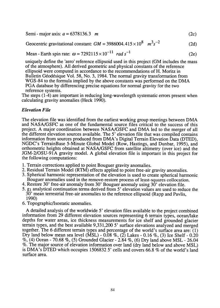
Semi - major axis: a = 6378136.3 m
Geocentric gravitational constant: GM = 3986004.415 x 10 8 m 3 s- 2
Mean - Earth spin rate: OJ = 7292115 x 10- 11 rad s-l
(2c)
(2d)
(2e)
uniquely define the 'zero' reference ellipsoid used in this project (GM includes the mass
of the atmosphere). All derived geometric and physical constants of the reference
ellipsoid were computed in accordance to the recommendations of H. Moritz in
Bulletin Geodesique Vol. 58, No.3, 1984. The normal gravity transformation from
WGS-84 to the formula implied by the above constants was perfomled on the DMA
PGA database by differencing precise equations for normal gravity for the two
reference systems.
The steps (1-4) are important in reducing long-wavelength systematic errors present when
calculating gravity anomalies (Heck 1990).
Elevation File
The elevation file was identified from the earliest working group meetings between DMA
and NASA/GSFC as one of the fundamental source files critical to the success of this
project. A major coordination between NASA/GSFC and DMA led to the merger of all
the different elevation sources available. The 5' elevation file that was compiled contains
information from sources produced from DMA's Digital Terrain Elevation Data (DTED),
NGDC's TerrainBase 5-Minute Global Model (Row, Hastings, and Dunbar, 1995), and
orthometric heights obtained at NASNGSFC from satellite altimetry (over ice) and the
JGM-2/0SU-91A gravity model. A global elevation file is important in this project for
the following computations:
1. Terrain corrections applied to point Bouguer gravity anomalies.
2. Residual Terrain Model (RTM) effects applied to point free-air gravity anomalies.
3. Spherical harmonic representation of the elevation is used to create spherical harmonic
Bouguer anomalies used in the remove-restore process of least-squares collocation.
4. Restore 30' free-air anomaly from 30' Bouguer anomaly using 30' elevation file.
5. gl analytical continuation terms derived from 5' elevation values are used to reduce the
30' mean terrestrial free-air anomalies to the reference ellipsoid (Rapp and Pavlis,
1990)
6. Topographic/Isostatic anomalies.
A detailed analysis of the worldwide 5' elevation files available to the project combined
information from 29 different elevation sources representing 6 terrain types, ocean/lake
depths for water areas, ice thickness measurements for ice shelf and grounded glacier
terrain types, and the best available 9,331,200 5' surface elevations analyzed and merged
together. The 6 different terrain types and percentage of the world's surface area are: (1)
Dry land below mean sea level (MSL) - 0.08 %, (2) Lakes - 0.16 %, (3) Ice Shelf - 0.20
%, (4) Ocean - 70.68 %, (5) Grounded Glacier - 2.84 %, (6) Dry land above MSL - 26.04
%. The major source of elevation information over land (dry land below and above MSL)
is DMA's DTED which occupies 15068325' cells and covers 66.8 % of the world's land
surface area.
84
Geocentric gravitational constant: GM = 3986004.415 x 10 8 m 3 s- 2
Mean - Earth spin rate: OJ = 7292115 x 10- 11 rad s-l
(2c)
(2d)
(2e)
uniquely define the 'zero' reference ellipsoid used in this project (GM includes the mass
of the atmosphere). All derived geometric and physical constants of the reference
ellipsoid were computed in accordance to the recommendations of H. Moritz in
Bulletin Geodesique Vol. 58, No.3, 1984. The normal gravity transformation from
WGS-84 to the formula implied by the above constants was perfomled on the DMA
PGA database by differencing precise equations for normal gravity for the two
reference systems.
The steps (1-4) are important in reducing long-wavelength systematic errors present when
calculating gravity anomalies (Heck 1990).
Elevation File
The elevation file was identified from the earliest working group meetings between DMA
and NASA/GSFC as one of the fundamental source files critical to the success of this
project. A major coordination between NASA/GSFC and DMA led to the merger of all
the different elevation sources available. The 5' elevation file that was compiled contains
information from sources produced from DMA's Digital Terrain Elevation Data (DTED),
NGDC's TerrainBase 5-Minute Global Model (Row, Hastings, and Dunbar, 1995), and
orthometric heights obtained at NASNGSFC from satellite altimetry (over ice) and the
JGM-2/0SU-91A gravity model. A global elevation file is important in this project for
the following computations:
1. Terrain corrections applied to point Bouguer gravity anomalies.
2. Residual Terrain Model (RTM) effects applied to point free-air gravity anomalies.
3. Spherical harmonic representation of the elevation is used to create spherical harmonic
Bouguer anomalies used in the remove-restore process of least-squares collocation.
4. Restore 30' free-air anomaly from 30' Bouguer anomaly using 30' elevation file.
5. gl analytical continuation terms derived from 5' elevation values are used to reduce the
30' mean terrestrial free-air anomalies to the reference ellipsoid (Rapp and Pavlis,
1990)
6. Topographic/Isostatic anomalies.
A detailed analysis of the worldwide 5' elevation files available to the project combined
information from 29 different elevation sources representing 6 terrain types, ocean/lake
depths for water areas, ice thickness measurements for ice shelf and grounded glacier
terrain types, and the best available 9,331,200 5' surface elevations analyzed and merged
together. The 6 different terrain types and percentage of the world's surface area are: (1)
Dry land below mean sea level (MSL) - 0.08 %, (2) Lakes - 0.16 %, (3) Ice Shelf - 0.20
%, (4) Ocean - 70.68 %, (5) Grounded Glacier - 2.84 %, (6) Dry land above MSL - 26.04
%. The major source of elevation information over land (dry land below and above MSL)
is DMA's DTED which occupies 15068325' cells and covers 66.8 % of the world's land
surface area.
84