

The estimation of the influence of different error sources on a predicted satellite position
accuracy is very important for a preparation of an optimum and efficient algorithm for
predictions calculations. Since the uncertainty in the Earth's gravity field description is one
of many factors influencing on the accuracy of predicted satellite positions we try to estimate uncertainties in predicted satellite positions due to uncertainties in gravity field models. Usually, predictions of accuracy of calculated satellite positions are derived from the
variance-covariance matrix. We did not used this method. In this paper we estimate an accuracy of predictions comparing predicted satellite positions which were calculated using
different geopotential models. In our calculations we applied an analytical theory of
geopotential perturbations (Wnuk, 1988, 1995a, 1995b). Using this theory we can estimate
not only errors in predictions, but also differences in gravity field models. Analyzing
predicted positions calculated with an inclusion of particular types of perturbations we can
estimate differences in particular groups of geopotential models coefficients.
CONTEMPORARY GEOPOTENTIAL MODELS
The Earth's gravity model is defined by the product of the gravitational constant and the
total mass of the Earth and the atmosphere GM, by the Earth's mean equatorial radius ae,
and by the spherical harmonic coefficients elm and Sim of the degree 1 and order m, where
2 :::;. I:::; lmax, 0 :::; m :::; I. Some geopotential models contain also the estimations of others
geophysical parameters, e.g. tides models and/or sea surface topography models.
The main characteristics of the recent and available geopotential models are shown in Table 1. According to the data used in a solution, two types of models are determined:
"satellite only" - from satellite tracking data only (e.g. GEM-T3S, GRIM4-S3/S4), and
"combined" - from a combination of satellite tracking, satellite altimetry, and surface gravimetric data (e.g. GEM-T3, GRIM4-C3/C4, OSU91A).
Different estimations of contemporary geopotential models show that they represent the
geoid with the 25 cm accuracy over the ocean area and with the 1 m accuracy over the
continents (e.g. Nerem et al, 1994b). Orbit:fits to precise satellite laser ranging tracking
data using different gravity models show that for the best contemporary models RMS residuals are on the 2-3 cm level for LAGEOS, 8-9 cm for Starlette and Ajisai, and 20-30
cm for some other satellites.
ERRORS IN PREDICTED SATELLITE POSITIONS
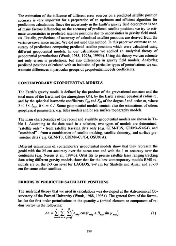
The analytical theory that we used in calculationS was developed at the Astronomical Observatory of the Poman University (Wnuk, 1988, 1995a). The general form of the formulas for the first order perturbations in the quantity & (orbital element or component of radius vector) is the following:
N
N
Q
..1& = L L L(Amkq cosV'mkq + Bmkq sin V'mkq)'
(1)
m=O k=-N q=-Q
199
accuracy is very important for a preparation of an optimum and efficient algorithm for
predictions calculations. Since the uncertainty in the Earth's gravity field description is one
of many factors influencing on the accuracy of predicted satellite positions we try to estimate uncertainties in predicted satellite positions due to uncertainties in gravity field models. Usually, predictions of accuracy of calculated satellite positions are derived from the
variance-covariance matrix. We did not used this method. In this paper we estimate an accuracy of predictions comparing predicted satellite positions which were calculated using
different geopotential models. In our calculations we applied an analytical theory of
geopotential perturbations (Wnuk, 1988, 1995a, 1995b). Using this theory we can estimate
not only errors in predictions, but also differences in gravity field models. Analyzing
predicted positions calculated with an inclusion of particular types of perturbations we can
estimate differences in particular groups of geopotential models coefficients.
CONTEMPORARY GEOPOTENTIAL MODELS
The Earth's gravity model is defined by the product of the gravitational constant and the
total mass of the Earth and the atmosphere GM, by the Earth's mean equatorial radius ae,
and by the spherical harmonic coefficients elm and Sim of the degree 1 and order m, where
2 :::;. I:::; lmax, 0 :::; m :::; I. Some geopotential models contain also the estimations of others
geophysical parameters, e.g. tides models and/or sea surface topography models.
The main characteristics of the recent and available geopotential models are shown in Table 1. According to the data used in a solution, two types of models are determined:
"satellite only" - from satellite tracking data only (e.g. GEM-T3S, GRIM4-S3/S4), and
"combined" - from a combination of satellite tracking, satellite altimetry, and surface gravimetric data (e.g. GEM-T3, GRIM4-C3/C4, OSU91A).
Different estimations of contemporary geopotential models show that they represent the
geoid with the 25 cm accuracy over the ocean area and with the 1 m accuracy over the
continents (e.g. Nerem et al, 1994b). Orbit:fits to precise satellite laser ranging tracking
data using different gravity models show that for the best contemporary models RMS residuals are on the 2-3 cm level for LAGEOS, 8-9 cm for Starlette and Ajisai, and 20-30
cm for some other satellites.
ERRORS IN PREDICTED SATELLITE POSITIONS
The analytical theory that we used in calculationS was developed at the Astronomical Observatory of the Poman University (Wnuk, 1988, 1995a). The general form of the formulas for the first order perturbations in the quantity & (orbital element or component of radius vector) is the following:
N
N
Q
..1& = L L L(Amkq cosV'mkq + Bmkq sin V'mkq)'
(1)
m=O k=-N q=-Q
199