

from new elevation data through topographic/isostatic models to ultimately yield a complete
global 30' x 30' anomaly file. In addition, an updated l°x.1 0 anomaly file based on
terrestrial data (both land and ocean) will be determined for use in the development of long
wavelength gravitational models.
The final stage of the data processing will be the development of several degree 360
models using different data sets, weighting procedures, and solution techniques. Several
new preliminary models will be made available to an international working group of the
International Geoid Service for evaluation. A final model will be selected based on
extensive tests of the preliminary models. The final model and accuracy estimates will be
released in early 1996. The model will be used to determine accurate geoid undulations that
will be available in gridded form.
MOTIVATION
Applications of Gravity Models
The representation of the Earth's gravitational potential in terms of a spherical harmonic
series has been an evolving task of the geodetic community for more than 40 years. As
satellite data and surface gravity have become more accurate and of greater spatial coverage,
the representations have been extended to degree 360 by combining numerous data types
into comprehensive solutions. A recent review of the progress made in the representation
of the Earth's gravitational potential may be found in Nerem et al. (1995). This paper
describes the extensive advances that have been made in the combination models since
1966. Representative degree 360 models have been described by Rapp and Pavlis (1990),
Basic et al. (1990), Rapp et al. (1991), and Gruber and Anzenhofer (1993).
The use of high degree gravity models is quite varied (Tscherning, 1983). Some of the
applications include: a) use in satellite orbit calculations (long wavelengths only); b) use in
simulation studies involving gravity-dependent quantities; c) calculation of geoid
undulations, and other gravimetric quantities; d) use as a reference model for regional
gravity calculations using least squares collocation and FFf procedures.
Perhaps the most extensive use of the high degree potential coefficient models has been in
the determination of the geoid undulation or height anomaly. This use has been driven by
the rapid evolution of the Global Positioning System (GPS) for ellipsoidal height
determination and the subsequent need for orthometric or normal heights. In practice, the
greatest accuracy through GPS is obtained for relative ellipsoid heights so relative
undulation (or undulation difference) determinations are an important quantity for many
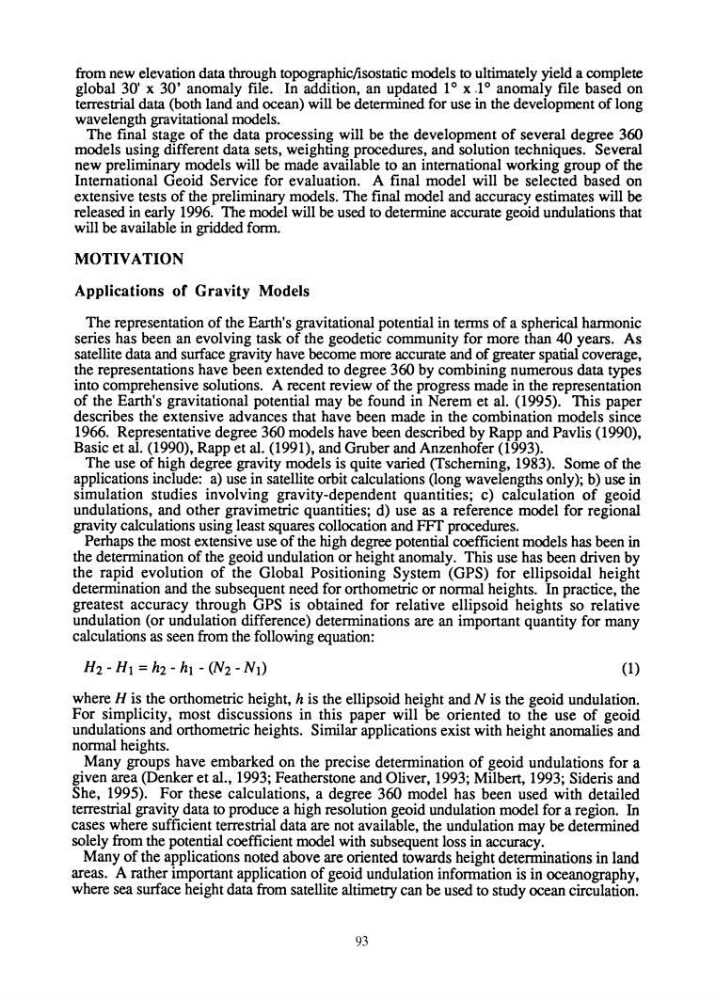
calculations as seen from the following equation:
(1)
where H is the orthometric height, h is the ellipsoid height and N is the geoid undulation.
For simplicity, most discussions in this paper will be oriented to the use of geoid
undulations and orthometric heights. Similar applications exist with height anomalies and
normal heights.
Many groups have embarked on the precise determination of geoid undulations for a
given area (Denker et al., 1993; Featherstone and Oliver, 1993; Milbert, 1993; Sideris and
She, 1995). For these calculations, a degree 360 model has been used with detailed
terrestrial gravity data to produce a high resolution geoid undulation model for a region. In
cases where sufficient terrestrial data are not available, the undulation may be determined
solely from the potential coefficient model with subsequent loss in accuracy.
Many of the applications noted above are oriented towards height determinations in land
areas. A rather important application of geoid undulation information is in oceanography,
where sea surface height data from satellite altimetry can be used to study ocean circulation.
93
global 30' x 30' anomaly file. In addition, an updated l°x.1 0 anomaly file based on
terrestrial data (both land and ocean) will be determined for use in the development of long
wavelength gravitational models.
The final stage of the data processing will be the development of several degree 360
models using different data sets, weighting procedures, and solution techniques. Several
new preliminary models will be made available to an international working group of the
International Geoid Service for evaluation. A final model will be selected based on
extensive tests of the preliminary models. The final model and accuracy estimates will be
released in early 1996. The model will be used to determine accurate geoid undulations that
will be available in gridded form.
MOTIVATION
Applications of Gravity Models
The representation of the Earth's gravitational potential in terms of a spherical harmonic
series has been an evolving task of the geodetic community for more than 40 years. As
satellite data and surface gravity have become more accurate and of greater spatial coverage,
the representations have been extended to degree 360 by combining numerous data types
into comprehensive solutions. A recent review of the progress made in the representation
of the Earth's gravitational potential may be found in Nerem et al. (1995). This paper
describes the extensive advances that have been made in the combination models since
1966. Representative degree 360 models have been described by Rapp and Pavlis (1990),
Basic et al. (1990), Rapp et al. (1991), and Gruber and Anzenhofer (1993).
The use of high degree gravity models is quite varied (Tscherning, 1983). Some of the
applications include: a) use in satellite orbit calculations (long wavelengths only); b) use in
simulation studies involving gravity-dependent quantities; c) calculation of geoid
undulations, and other gravimetric quantities; d) use as a reference model for regional
gravity calculations using least squares collocation and FFf procedures.
Perhaps the most extensive use of the high degree potential coefficient models has been in
the determination of the geoid undulation or height anomaly. This use has been driven by
the rapid evolution of the Global Positioning System (GPS) for ellipsoidal height
determination and the subsequent need for orthometric or normal heights. In practice, the
greatest accuracy through GPS is obtained for relative ellipsoid heights so relative
undulation (or undulation difference) determinations are an important quantity for many
calculations as seen from the following equation:
(1)
where H is the orthometric height, h is the ellipsoid height and N is the geoid undulation.
For simplicity, most discussions in this paper will be oriented to the use of geoid
undulations and orthometric heights. Similar applications exist with height anomalies and
normal heights.
Many groups have embarked on the precise determination of geoid undulations for a
given area (Denker et al., 1993; Featherstone and Oliver, 1993; Milbert, 1993; Sideris and
She, 1995). For these calculations, a degree 360 model has been used with detailed
terrestrial gravity data to produce a high resolution geoid undulation model for a region. In
cases where sufficient terrestrial data are not available, the undulation may be determined
solely from the potential coefficient model with subsequent loss in accuracy.
Many of the applications noted above are oriented towards height determinations in land
areas. A rather important application of geoid undulation information is in oceanography,
where sea surface height data from satellite altimetry can be used to study ocean circulation.
93