

Niessen et al: Hi~h-Resolution Seismic Stratigravhv of Lake Sediments on the Taymyr Peninsula
441
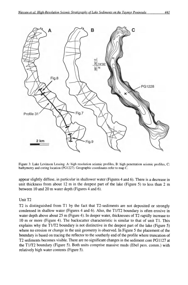
Figure 3: Lake Levinson Lessing. A: high resolution seismic profiles, B: high penetration seismic profiles, C:
bathymetry and coring location (PG 1227). Geographic coordinates refer to map C.
appear slightly diffuse, in particular in shallower water (Figures 4 and 6). There is a decrease in
unit thickness from about 12 m in the deepest part of the lake (Figure 5) to less than 2 m
between 10 and 20 m water depth (Figures 4 and 6).
UnitT2
T2 is distinguished from Tl by the fact that T2-sediments are not deposited or strongly
condensed in shallow water (Figures 4 and 6). Also, the TlIT2 boundary is often erosive in
water depth above about 25 m (Figure 4). In deeper water, thicknesses of T2 rapidly increase to
10 m or more (Figure 4). The backscatter characteristic is similar to that of unit Tl. This
explains why the Tlff2 boundary is not distinctive in the deepest part of the lake (Figure 5)
where no erosion or change in the unit geometry is observed. In Figure 5 the placement of the
boundary is based on tracing the reflector to the southerly end of the profile where truncation of
T2 sediments becomes visible. There are no significant changes in the sediment core PG 1127 at
the Tlff2 boundary (Figure 5). Both units comprise massive muds (Ebel pers. comm.) with
relatively high water contents (Figure 5).
441
Figure 3: Lake Levinson Lessing. A: high resolution seismic profiles, B: high penetration seismic profiles, C:
bathymetry and coring location (PG 1227). Geographic coordinates refer to map C.
appear slightly diffuse, in particular in shallower water (Figures 4 and 6). There is a decrease in
unit thickness from about 12 m in the deepest part of the lake (Figure 5) to less than 2 m
between 10 and 20 m water depth (Figures 4 and 6).
UnitT2
T2 is distinguished from Tl by the fact that T2-sediments are not deposited or strongly
condensed in shallow water (Figures 4 and 6). Also, the TlIT2 boundary is often erosive in
water depth above about 25 m (Figure 4). In deeper water, thicknesses of T2 rapidly increase to
10 m or more (Figure 4). The backscatter characteristic is similar to that of unit Tl. This
explains why the Tlff2 boundary is not distinctive in the deepest part of the lake (Figure 5)
where no erosion or change in the unit geometry is observed. In Figure 5 the placement of the
boundary is based on tracing the reflector to the southerly end of the profile where truncation of
T2 sediments becomes visible. There are no significant changes in the sediment core PG 1127 at
the Tlff2 boundary (Figure 5). Both units comprise massive muds (Ebel pers. comm.) with
relatively high water contents (Figure 5).