

with transgressive and parabolic dunes can be found in the region (López-Portillo
et al. 2011). Long-term (40 years) means that annual precipitation is 1,500 mm,
and mean monthly temperatures range from 17 °C in January to 33 °C in June.
Eighty percent of the rain falls between May and October and the dry season
occurs from November to April.
In 1885, Ignacio Ochoa Villagómez, an agronomist, constructed an artificial
dune at the study site with the basic idea that it would protect urban infrastructure
by stopping the sand blowing from nearby mobile dunes, until the trees and grasses
that were introduced stabilized the sand. Australian sea-pines (C. equisetifolia)
were planted, since they tolerate considerable sand accretion and the low nutrient
and moisture conditions of sand dunes. This plantation largely prevented the sand
from blowing into the neighboring city and then became protected and remained a
cornerstone for the local inhabitants (Siemens et al. 2006). It was known as ‘‘La
Pinera’’ (the pine grove), until the present century when the port began to expand:
La Pinera was partially cut down and its surface contracted to less than 50 % of its
original area.
96°10'0"W
96°10'0"W
96°20'0"W
96°20'0"W
19°10'0"N
19°10'0"N
90°0'0"W
90°0'0"W
105°0'0"W
105°0'0"W
30°0'0"N
30°0'0"N
20°0'0"N
20°0'0"N
Gulf of Mexico
Mexico
Port of
Veracruz
USA
.
m
0
5
1 0 k
2.5
study site
River Medio
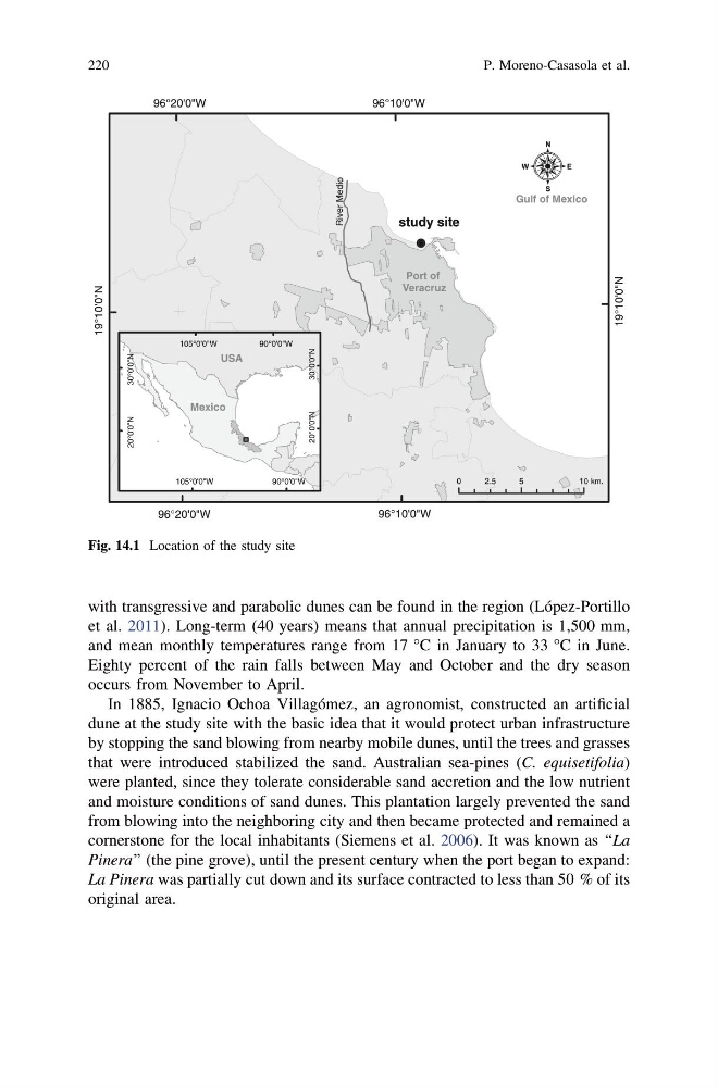
Fig. 14.1 Location of the study site
220
P. Moreno-Casasola et al.
et al. 2011). Long-term (40 years) means that annual precipitation is 1,500 mm,
and mean monthly temperatures range from 17 °C in January to 33 °C in June.
Eighty percent of the rain falls between May and October and the dry season
occurs from November to April.
In 1885, Ignacio Ochoa Villagómez, an agronomist, constructed an artificial
dune at the study site with the basic idea that it would protect urban infrastructure
by stopping the sand blowing from nearby mobile dunes, until the trees and grasses
that were introduced stabilized the sand. Australian sea-pines (C. equisetifolia)
were planted, since they tolerate considerable sand accretion and the low nutrient
and moisture conditions of sand dunes. This plantation largely prevented the sand
from blowing into the neighboring city and then became protected and remained a
cornerstone for the local inhabitants (Siemens et al. 2006). It was known as ‘‘La
Pinera’’ (the pine grove), until the present century when the port began to expand:
La Pinera was partially cut down and its surface contracted to less than 50 % of its
original area.
96°10'0"W
96°10'0"W
96°20'0"W
96°20'0"W
19°10'0"N
19°10'0"N
90°0'0"W
90°0'0"W
105°0'0"W
105°0'0"W
30°0'0"N
30°0'0"N
20°0'0"N
20°0'0"N
Gulf of Mexico
Mexico
Port of
Veracruz
USA
.
m
0
5
1 0 k
2.5
study site
River Medio
Fig. 14.1 Location of the study site
220
P. Moreno-Casasola et al.