

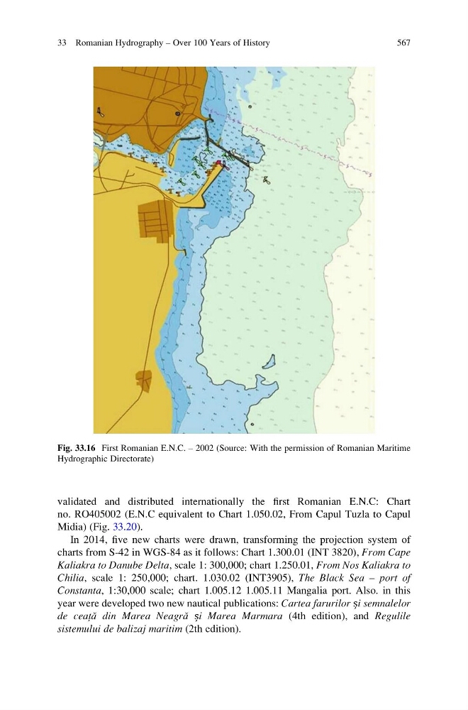
validated and distributed internationally the first Romanian E.N.C: Chart
no. RO405002 (E.N.C equivalent to Chart 1.050.02, From Capul Tuzla to Capul
Midia) (Fig. 33.20).
In 2014, five new charts were drawn, transforming the projection system of
charts from S-42 in WGS-84 as it follows: Chart 1.300.01 (INT 3820), From Cape
Kaliakra to Danube Delta, scale 1: 300,000; chart 1.250.01, From Nos Kaliakra to
Chilia, scale 1: 250,000; chart. 1.030.02 (INT3905), The Black Sea – port of
Constanta, 1:30,000 scale; chart 1.005.12 1.005.11 Mangalia port. Also. in this
year were developed two new nautical publications: Cartea farurilor și semnalelor
de ceața ˘ din Marea Neagra ˘ și Marea Marmara (4th edition), and Regulile
sistemului de balizaj maritim (2th edition).
Fig. 33.16 First Romanian E.N.C. – 2002 (Source: With the permission of Romanian Maritime
Hydrographic Directorate)
33 Romanian Hydrography – Over 100 Years of History
567
no. RO405002 (E.N.C equivalent to Chart 1.050.02, From Capul Tuzla to Capul
Midia) (Fig. 33.20).
In 2014, five new charts were drawn, transforming the projection system of
charts from S-42 in WGS-84 as it follows: Chart 1.300.01 (INT 3820), From Cape
Kaliakra to Danube Delta, scale 1: 300,000; chart 1.250.01, From Nos Kaliakra to
Chilia, scale 1: 250,000; chart. 1.030.02 (INT3905), The Black Sea – port of
Constanta, 1:30,000 scale; chart 1.005.12 1.005.11 Mangalia port. Also. in this
year were developed two new nautical publications: Cartea farurilor și semnalelor
de ceața ˘ din Marea Neagra ˘ și Marea Marmara (4th edition), and Regulile
sistemului de balizaj maritim (2th edition).
Fig. 33.16 First Romanian E.N.C. – 2002 (Source: With the permission of Romanian Maritime
Hydrographic Directorate)
33 Romanian Hydrography – Over 100 Years of History
567