

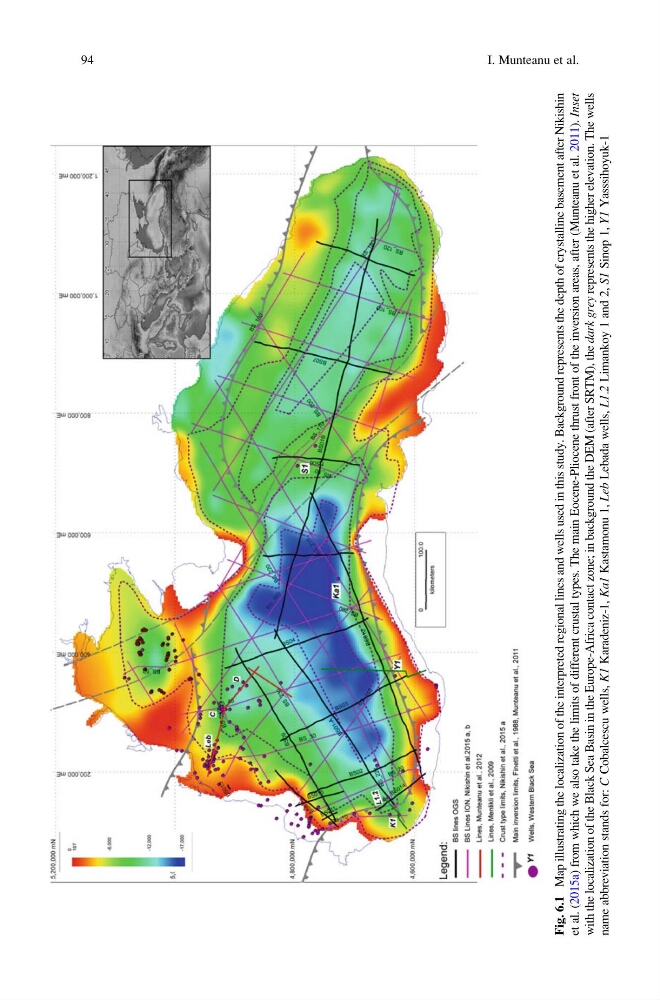
Fig. 6.1
Map illustrating the localization of the interpreted regional lines and wells used in this study. Background represents the depth of crystalline basement after Nikishin
et al. (2015a) from which we also take the limits of different crustal types. The main Eocene-Pliocene thrust front of the inversion areas, after (Munteanu et al. 2011).
Inset
with the localization of the Black Sea Basin in the Europe-Africa contact zone; in background the DEM (after SRTM), the
dark grey represents the higher elevation. The wells
name abbreviation stands for:
C Cobalcescu wells,
K1 Karadeniz-1,
Ka1 Kastamonu 1,
Leb Lebada wells,
L1.2 Limankoy 1 and 2,
S1 Sinop 1,
Y1 Yasssihoyuk-1
94
I. Munteanu et al.
Map illustrating the localization of the interpreted regional lines and wells used in this study. Background represents the depth of crystalline basement after Nikishin
et al. (2015a) from which we also take the limits of different crustal types. The main Eocene-Pliocene thrust front of the inversion areas, after (Munteanu et al. 2011).
Inset
with the localization of the Black Sea Basin in the Europe-Africa contact zone; in background the DEM (after SRTM), the
dark grey represents the higher elevation. The wells
name abbreviation stands for:
C Cobalcescu wells,
K1 Karadeniz-1,
Ka1 Kastamonu 1,
Leb Lebada wells,
L1.2 Limankoy 1 and 2,
S1 Sinop 1,
Y1 Yasssihoyuk-1
94
I. Munteanu et al.