

92
5 Challenges: Sectoral Descriptions
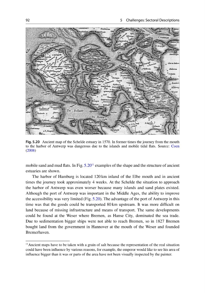
Fig. 5.20 Ancient map of the Schelde estuary in 1570. In former times the journey from the mouth
to the harbor of Antwerp was dangerous due to the islands and mobile tidal flats. Source: Coen
(2008)
mobile sand and mud flats. In Fig. 5.20
11 examples of the shape and the structure of ancient
estuaries are shown.
The harbor of Hamburg is located 120 km inland of the Elbe mouth and in ancient
times the journey took approximately 4 weeks. At the Schelde the situation to approach
the harbor of Antwerp was even worser because many islands and sand plates existed.
Although the port of Antwerp was important in the Middle Ages, the ability to improve
the accessibility was very limited (Fig. 5.20). The advantage of the port of Antwerp in this
time was that the goods could be transported 80 km upstream. It was more difficult on
land because of missing infrastructure and means of transport. The same developments
could be found at the Weser where Bremen, as Hanse City, dominated the sea trade.
Due to sedimentation bigger ships were not able to reach Bremen, so in 1827 Bremen
bought land from the government in Hannover at the mouth of the Weser and founded
Bremerhaven.
11 Ancient maps have to be taken with a grain of salt because the representation of the real situation
could have been influence by various reasons, for example, the emperor would like to see his area of
influence bigger than it was or parts of the area have not been visually inspected by the painter.
5 Challenges: Sectoral Descriptions
Fig. 5.20 Ancient map of the Schelde estuary in 1570. In former times the journey from the mouth
to the harbor of Antwerp was dangerous due to the islands and mobile tidal flats. Source: Coen
(2008)
mobile sand and mud flats. In Fig. 5.20
11 examples of the shape and the structure of ancient
estuaries are shown.
The harbor of Hamburg is located 120 km inland of the Elbe mouth and in ancient
times the journey took approximately 4 weeks. At the Schelde the situation to approach
the harbor of Antwerp was even worser because many islands and sand plates existed.
Although the port of Antwerp was important in the Middle Ages, the ability to improve
the accessibility was very limited (Fig. 5.20). The advantage of the port of Antwerp in this
time was that the goods could be transported 80 km upstream. It was more difficult on
land because of missing infrastructure and means of transport. The same developments
could be found at the Weser where Bremen, as Hanse City, dominated the sea trade.
Due to sedimentation bigger ships were not able to reach Bremen, so in 1827 Bremen
bought land from the government in Hannover at the mouth of the Weser and founded
Bremerhaven.
11 Ancient maps have to be taken with a grain of salt because the representation of the real situation
could have been influence by various reasons, for example, the emperor would like to see his area of
influence bigger than it was or parts of the area have not been visually inspected by the painter.