

3 Processing Remotely Sensed Data: Hardware and Software Considerations
55
Phtogrammetrically Derived Digital Elevation Model and
Oigitzed stereoscopic photography
Edited digital elevation model (OEM)
Reflief map of the OEM
Onboimage
Orthopboto draped over OEM in 3-d perspective view
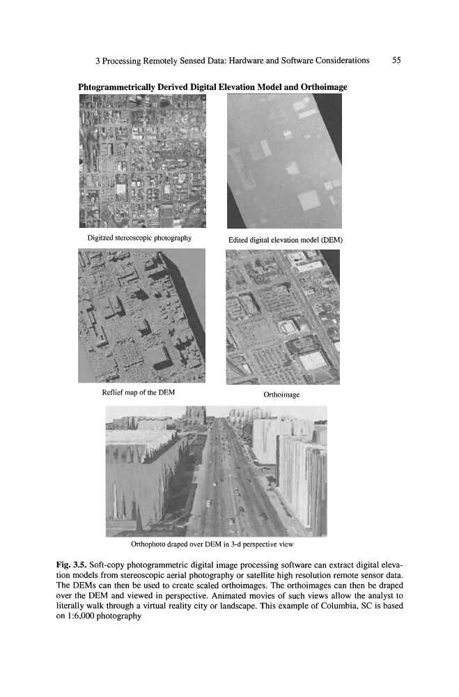
Fig. 3.5. Soft-copy photogrammetric digital image processing software can extract digital elevation models from stereoscopic aerial photography or satellite high resolution remote sensor data.
The OEMs can then be used to create scaled orthoimages. The orthoimages can then be draped
over the OEM and viewed in perspective. Animated movies of such views allow the analyst to
literally walk through a virtual reality city or landscape. This example of Columbia, SC is based
on I :6,000 photography
55
Phtogrammetrically Derived Digital Elevation Model and
Oigitzed stereoscopic photography
Edited digital elevation model (OEM)
Reflief map of the OEM
Onboimage
Orthopboto draped over OEM in 3-d perspective view
Fig. 3.5. Soft-copy photogrammetric digital image processing software can extract digital elevation models from stereoscopic aerial photography or satellite high resolution remote sensor data.
The OEMs can then be used to create scaled orthoimages. The orthoimages can then be draped
over the OEM and viewed in perspective. Animated movies of such views allow the analyst to
literally walk through a virtual reality city or landscape. This example of Columbia, SC is based
on I :6,000 photography