

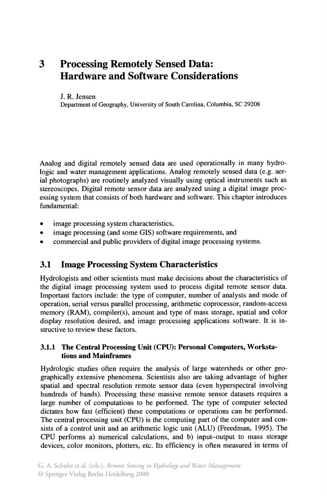
3
Processing Remotely Sensed Data:
Hardware and Software Considerations
J. R. Jensen
Department of Geography, University of South Carolina, Columbia, SC 29208
Analog and digital remotely sensed data are used operationally in many hydrologic and water management applications. Analog remotely sensed data (e.g. aerial photographs) are routinely analyzed visually using optical instruments such as
stereoscopes. Digital remote sensor data are analyzed using a digital image processing system that consists of both hardware and software. This chapter introduces
fundamental:
• image processing system characteristics,
• image processing (and some GIS) software requirements, and
• commercial and public providers of digital image processing systems.
3.1 Image Processing System Characteristics
Hydrologists and other scientists must make decisions about the characteristics of
the digital image processing system used to process digital remote sensor data.
Important factors include: the type of computer, number of analysts and mode of
operation, serial versus parallel processing, arithmetic coprocessor, random-access
memory (RAM), compiler(s), amount and type of mass storage, spatial and color
display resolution desired, and image processing applications software. It is instructive to review these factors.
3.1.1 The Central Processing Unit (CPU): Personal Computers, Workstations and Mainframes
Hydrologic studies often require the analysis of large watersheds or other geographically extensive phenomena. Scientists also are taking advantage of higher
spatial and spectral resolution remote sensor data (even hyperspectral involving
hundreds of bands). Processing these massive remote sensor datasets requires a
large number of computations to be performed. The type of computer selected
dictates how fast (efficient) these computations or operations can be performed.
The central processing unit (CPU) is the computing part of the computer and consists of a control unit and an arithmetic logic unit (ALU) (Freedman, 1995). The
CPU performs a) numerical calculations, and b) input-output to mass storage
devices, color monitors, plotters, etc. Its efficiency is often measured in terms of
G. A. Schultz et al. (eds.), Remote Sensing in Hydrology and Water Management
© Springer-Verlag Berlin Heidelberg 2000
Processing Remotely Sensed Data:
Hardware and Software Considerations
J. R. Jensen
Department of Geography, University of South Carolina, Columbia, SC 29208
Analog and digital remotely sensed data are used operationally in many hydrologic and water management applications. Analog remotely sensed data (e.g. aerial photographs) are routinely analyzed visually using optical instruments such as
stereoscopes. Digital remote sensor data are analyzed using a digital image processing system that consists of both hardware and software. This chapter introduces
fundamental:
• image processing system characteristics,
• image processing (and some GIS) software requirements, and
• commercial and public providers of digital image processing systems.
3.1 Image Processing System Characteristics
Hydrologists and other scientists must make decisions about the characteristics of
the digital image processing system used to process digital remote sensor data.
Important factors include: the type of computer, number of analysts and mode of
operation, serial versus parallel processing, arithmetic coprocessor, random-access
memory (RAM), compiler(s), amount and type of mass storage, spatial and color
display resolution desired, and image processing applications software. It is instructive to review these factors.
3.1.1 The Central Processing Unit (CPU): Personal Computers, Workstations and Mainframes
Hydrologic studies often require the analysis of large watersheds or other geographically extensive phenomena. Scientists also are taking advantage of higher
spatial and spectral resolution remote sensor data (even hyperspectral involving
hundreds of bands). Processing these massive remote sensor datasets requires a
large number of computations to be performed. The type of computer selected
dictates how fast (efficient) these computations or operations can be performed.
The central processing unit (CPU) is the computing part of the computer and consists of a control unit and an arithmetic logic unit (ALU) (Freedman, 1995). The
CPU performs a) numerical calculations, and b) input-output to mass storage
devices, color monitors, plotters, etc. Its efficiency is often measured in terms of
G. A. Schultz et al. (eds.), Remote Sensing in Hydrology and Water Management
© Springer-Verlag Berlin Heidelberg 2000