

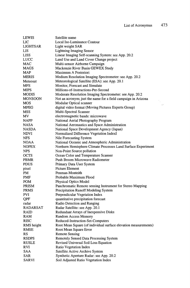
LEWIS
LIC
LIGHTSAR
LIS
LISS
LUCC
MAC
MAGS
MAP
MERIS
Meteosat
MFS
MIPS
MODIS
MONSOON
MOS
MPEG
MSS
MV
NAPP
NASA
NASDA
NDVI
NFS
NOAA
NOPEX
NPS
OCTS
PBMR
PDUS
pixel
PM
PMF
POM
PRISM
PRMS
PVI
QPF
radar
RADARSAT
RAID
RAM
RISC
RMS height
RMSE
RS
RSDPS
RUSLE
RVI
SAA
SAR
SARVI
Satellite name
Local Iso-Luminance Contour
Light weight SAR
Lightning Imaging Sensor
List of Acronymus
473
Linear Imaging Self-scanning System: see App. 20.2
Land Use and Land Cover Change project
Multi-sensor Airborne Campaign
Mackenzie River Basin GEWEX Study
Maximum A Posteriori
Medium Resolution Imaging Spectrometer: see App. 20.2
Meteorological Satellite (ESA): see App. 20.1
Monitor, Forecast and Simulate
Milli ons-of -Instructions-Per-Second
Moderate Resolution Imaging Spectrometer: see App. 20.2
Not an acronym; just the name for a field campaign in Arizona
Modular Optical scanner
digital video format (Moving Pictures Experts Group)
Multi-Spectral Scanner
electromagnetic bands: microwave
National Aerial Photography Program
National Aeronautics and Space Administration
National Space Development Agency (Japan)
Normalized Difference Vegetation IndexI
Nile Forecasting System
National Oceanic and Atmospheric Administration
Northern Hemisphere Climate Processes Land Surface Experiment
Non-Point Source pollution
Ocean Color and Temperature Scanner
Push Broom Microwave Radiometer
Primary Data User System
Picture Element
Penman-Monteith
Probable Maximum Flood
Physical Optics Model
Panchromatic Remote sensing Instrument for Stereo Mapping
Precipitation Runoff Modeling System
Perpendicular Vegetation Index
quantitative precipitation forecast
Radio Detection and Ranging
Radar Satellite: see App. 20.1
Redundant Arrays of Inexpensive Disks
Random Access Memory
Reduced-Instruction-Set -Computers
Root Mean Square (of individual surface elevation measurements)
Root Mean Square Error
Remote Sensing
Remotely Sensed Data Processing System
Revised Universal Soil Loss Equation
Ratio Vegetation Index
Satellite Active Archive System
Synthetic Aperture Radar: see App. 20.2
Soil Adjusted Ratio Vegetation Index
LIC
LIGHTSAR
LIS
LISS
LUCC
MAC
MAGS
MAP
MERIS
Meteosat
MFS
MIPS
MODIS
MONSOON
MOS
MPEG
MSS
MV
NAPP
NASA
NASDA
NDVI
NFS
NOAA
NOPEX
NPS
OCTS
PBMR
PDUS
pixel
PM
PMF
POM
PRISM
PRMS
PVI
QPF
radar
RADARSAT
RAID
RAM
RISC
RMS height
RMSE
RS
RSDPS
RUSLE
RVI
SAA
SAR
SARVI
Satellite name
Local Iso-Luminance Contour
Light weight SAR
Lightning Imaging Sensor
List of Acronymus
473
Linear Imaging Self-scanning System: see App. 20.2
Land Use and Land Cover Change project
Multi-sensor Airborne Campaign
Mackenzie River Basin GEWEX Study
Maximum A Posteriori
Medium Resolution Imaging Spectrometer: see App. 20.2
Meteorological Satellite (ESA): see App. 20.1
Monitor, Forecast and Simulate
Milli ons-of -Instructions-Per-Second
Moderate Resolution Imaging Spectrometer: see App. 20.2
Not an acronym; just the name for a field campaign in Arizona
Modular Optical scanner
digital video format (Moving Pictures Experts Group)
Multi-Spectral Scanner
electromagnetic bands: microwave
National Aerial Photography Program
National Aeronautics and Space Administration
National Space Development Agency (Japan)
Normalized Difference Vegetation IndexI
Nile Forecasting System
National Oceanic and Atmospheric Administration
Northern Hemisphere Climate Processes Land Surface Experiment
Non-Point Source pollution
Ocean Color and Temperature Scanner
Push Broom Microwave Radiometer
Primary Data User System
Picture Element
Penman-Monteith
Probable Maximum Flood
Physical Optics Model
Panchromatic Remote sensing Instrument for Stereo Mapping
Precipitation Runoff Modeling System
Perpendicular Vegetation Index
quantitative precipitation forecast
Radio Detection and Ranging
Radar Satellite: see App. 20.1
Redundant Arrays of Inexpensive Disks
Random Access Memory
Reduced-Instruction-Set -Computers
Root Mean Square (of individual surface elevation measurements)
Root Mean Square Error
Remote Sensing
Remotely Sensed Data Processing System
Revised Universal Soil Loss Equation
Ratio Vegetation Index
Satellite Active Archive System
Synthetic Aperture Radar: see App. 20.2
Soil Adjusted Ratio Vegetation Index