

20 Future Perspectives
455
There are a number of existing or soon-to-be launched sensors that may provide
useful hydrologic measurements. These include sensors that in principle at least
can measure just about all hydrologic variables. Unfortunately being able to make
a measurement is only part of the story with satellite remote sensing. One also has
to consider the time frequency of measurement as well as the spatial resolution.
For example, the JERS-1 SAR at 1.4 GHz should be a useful instrument for measuring soil moisture, but its 46 day repeat cycle renders it essentially useless for
obtaining useful information on soil moisture. Similarly, the 19 GHz channel on
the SSMII platform should provide useful information on snow depth, but its large
footprint greatly reduces its capabilities for measuring snow in alpine regions.
NASA's Earth Observational System (EOS) (Butler et aI., 1988), and its International partners from Europe and Japan will lead to considerable advances in the
understanding of all the earth sciences, including hydrology. The EOS instruments
of most interest to hydrologists would include the MODIS and AMSR, the latter is
a Japanese microwave instrument with a C-band radiometer which should provide
interesting measurements of the land surface soil moisture conditions and deep
snow conditions. EOS also includes the organization of a data information and
archiving system which is extremely important. This data system will allow many
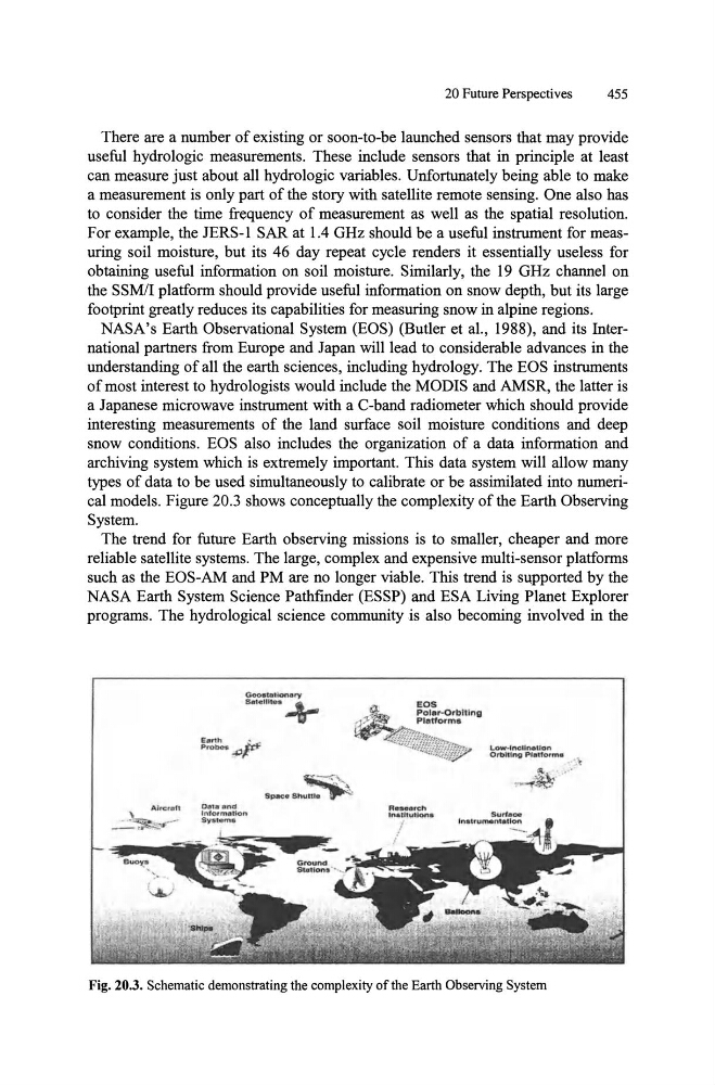
types of data to be used simultaneously to calibrate or be assimilated into numerical models. Figure 20.3 shows conceptually the complexity of the Earth Observing
System.
The trend for future Earth observing missions is to smaller, cheaper and more
reliable satellite systems. The large, complex and expensive multi-sensor platforms
such as the EOS-AM and PM are no longer viable. This trend is supported by the
NASA Earth System Science Pathfmder (ESSP) and ESA Living Planet Explorer
programs. The hydrological science community is also becoming involved in the
Geoatotlonary
s.t.llite. ~
~":,.
Space Shuttle -~
Fig. 20.3. Schematic demonstrating the complexity of the Earth Observing System
455
There are a number of existing or soon-to-be launched sensors that may provide
useful hydrologic measurements. These include sensors that in principle at least
can measure just about all hydrologic variables. Unfortunately being able to make
a measurement is only part of the story with satellite remote sensing. One also has
to consider the time frequency of measurement as well as the spatial resolution.
For example, the JERS-1 SAR at 1.4 GHz should be a useful instrument for measuring soil moisture, but its 46 day repeat cycle renders it essentially useless for
obtaining useful information on soil moisture. Similarly, the 19 GHz channel on
the SSMII platform should provide useful information on snow depth, but its large
footprint greatly reduces its capabilities for measuring snow in alpine regions.
NASA's Earth Observational System (EOS) (Butler et aI., 1988), and its International partners from Europe and Japan will lead to considerable advances in the
understanding of all the earth sciences, including hydrology. The EOS instruments
of most interest to hydrologists would include the MODIS and AMSR, the latter is
a Japanese microwave instrument with a C-band radiometer which should provide
interesting measurements of the land surface soil moisture conditions and deep
snow conditions. EOS also includes the organization of a data information and
archiving system which is extremely important. This data system will allow many
types of data to be used simultaneously to calibrate or be assimilated into numerical models. Figure 20.3 shows conceptually the complexity of the Earth Observing
System.
The trend for future Earth observing missions is to smaller, cheaper and more
reliable satellite systems. The large, complex and expensive multi-sensor platforms
such as the EOS-AM and PM are no longer viable. This trend is supported by the
NASA Earth System Science Pathfmder (ESSP) and ESA Living Planet Explorer
programs. The hydrological science community is also becoming involved in the
Geoatotlonary
s.t.llite. ~
~":,.
Space Shuttle -~
Fig. 20.3. Schematic demonstrating the complexity of the Earth Observing System