

404
I. Papadakis and G.A. Schultz
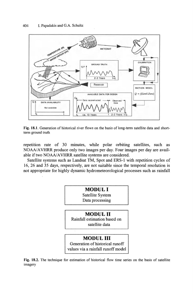
CAUBAATION'
GROUND TRUTH
MATHEM, MODEL
Q • f!.Sattll.Dura)
Fig. 18.1. Generation of historical river flows on the basis of long-term satellite data and shortterm ground truth
repetition rate of 30 minutes, while polar orbiting satellites, such as
NOAA!AVHRR produce only two images per day. Four images per day are available if two NOAA! A VHRR satellite systems are considered.
Satellite systems such as Landsat TM, Spot and ERS-I with repetition cycles of
16, 26 and 35 days, respectively, are not suitable since the temporal resolution is
not appropriate for highly dynamic hydrometeorological processes such as rainfall
MODULI
Satellite System
Data processing
MODULII
Rainfall estimation based on
satellite data
MODULIII
Generation of historical runoff
values via a rainfall runoff model
Fig. 18.2. The technique for estimation of historical flow time series on the basis of satellite
imagery
I. Papadakis and G.A. Schultz
CAUBAATION'
GROUND TRUTH
MATHEM, MODEL
Q • f!.Sattll.Dura)
Fig. 18.1. Generation of historical river flows on the basis of long-term satellite data and shortterm ground truth
repetition rate of 30 minutes, while polar orbiting satellites, such as
NOAA!AVHRR produce only two images per day. Four images per day are available if two NOAA! A VHRR satellite systems are considered.
Satellite systems such as Landsat TM, Spot and ERS-I with repetition cycles of
16, 26 and 35 days, respectively, are not suitable since the temporal resolution is
not appropriate for highly dynamic hydrometeorological processes such as rainfall
MODULI
Satellite System
Data processing
MODULII
Rainfall estimation based on
satellite data
MODULIII
Generation of historical runoff
values via a rainfall runoff model
Fig. 18.2. The technique for estimation of historical flow time series on the basis of satellite
imagery