

15 Introduction to and General Aspects of Water Management
331
seasonal vegetation dynamics, the temporal changes can be deducted. The thermal
channel can also be of help in differentiation wet areas from adjoining drier lands.
The temperatures of moist areas at midday are often lower than those of surrounding
drier regions because of evapo(transpi)ration. At night, the contrast can be reversed.
Monitoring of seasonal inundation and floods have made use of these contrasts (Berg
et al., 1979). Water management of alluvial plains requires information on the microtopography where height differences are too small to be determined by conventional
photogrammetry. Satellite imagery during an inundation can provide valuable contour
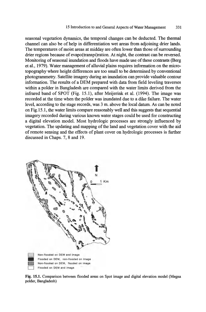
information. The results of a DEM prepared with data from field leveling traverses
within a polder in Bangladesh are compared with the water limits derived from the
infrared band of SPOT (Fig. 15.1), after Meijerink et al. (1994). The image was
recorded at the time when the polder was inundated due to a dike failure. The water
level, according to the stage records, was 3 m. above the local datum. As can be noted
on Fig. 15 .1, the water limits compare reasonably well and this suggests that sequential
imagery recorded during various known water stages could be used for constructing
a digital elevation model. Most hydrologic processes are strongly influenced by
vegetation. The updating and mapping of the land and vegetation cover with the aid
of remote sensing and the effects of plant cover on hydrologic processes is further
discussed in Chaps. 7, 8 and 19.
§
Non·flooded on OEM and Image
•
Fl ooded on OEM , non·flooded on Image
lID Non·tlooded on OEM. flooded on Imago
o Flooded on OEM and Image
Fig. IS.1. Comparison between flooded areas on Spot image and digital elevation model (Megna
polder, Bangladesh)
331
seasonal vegetation dynamics, the temporal changes can be deducted. The thermal
channel can also be of help in differentiation wet areas from adjoining drier lands.
The temperatures of moist areas at midday are often lower than those of surrounding
drier regions because of evapo(transpi)ration. At night, the contrast can be reversed.
Monitoring of seasonal inundation and floods have made use of these contrasts (Berg
et al., 1979). Water management of alluvial plains requires information on the microtopography where height differences are too small to be determined by conventional
photogrammetry. Satellite imagery during an inundation can provide valuable contour
information. The results of a DEM prepared with data from field leveling traverses
within a polder in Bangladesh are compared with the water limits derived from the
infrared band of SPOT (Fig. 15.1), after Meijerink et al. (1994). The image was
recorded at the time when the polder was inundated due to a dike failure. The water
level, according to the stage records, was 3 m. above the local datum. As can be noted
on Fig. 15 .1, the water limits compare reasonably well and this suggests that sequential
imagery recorded during various known water stages could be used for constructing
a digital elevation model. Most hydrologic processes are strongly influenced by
vegetation. The updating and mapping of the land and vegetation cover with the aid
of remote sensing and the effects of plant cover on hydrologic processes is further
discussed in Chaps. 7, 8 and 19.
§
Non·flooded on OEM and Image
•
Fl ooded on OEM , non·flooded on Image
lID Non·tlooded on OEM. flooded on Imago
o Flooded on OEM and Image
Fig. IS.1. Comparison between flooded areas on Spot image and digital elevation model (Megna
polder, Bangladesh)