

14 Groundwater
311
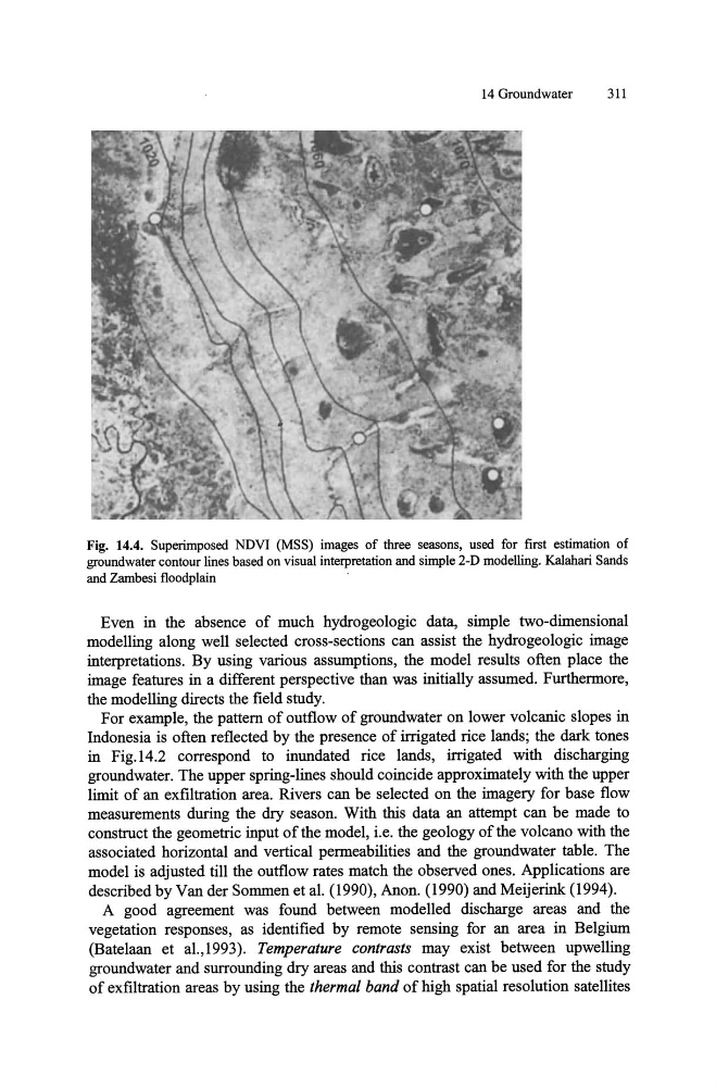
Fig. 14.4. Superimposed NDVI (MSS) images of three seasons, used for first estimation of
groundwater contour lines based on visual interpretation and simple 2-D modelling. Kalahari Sands
and Zambesi floodplain
Even in the absence of much hydrogeologic data, simple two-dimensional
modelling along well selected cross-sections can assist the hydrogeologic image
interpretations. By using various assumptions, the model results often place the
image features in a different perspective than was initially assumed. Furthermore,
the modelling directs the field study.
For example, the pattern of outflow of groundwater on lower volcanic slopes in
Indonesia is often reflected by the presence of irrigated rice lands; the dark tones
in Fig.14.2 correspond to inundated rice lands, irrigated with discharging
groundwater. The upper spring-lines should coincide approximately with the upper
limit of an ex filtration area. Rivers can be selected on the imagery for base flow
measurements during the dry season. With this data an attempt can be made to
construct the geometric input of the model, i.e. the geology of the volcano with the
associated horizontal and vertical permeabilities and the groundwater table. The
model is adjusted till the outflow rates match the observed ones. Applications are
described by Van der Sommen et al. (1990), Anon. (1990) and Meijerink (1994).
A good agreement was found between modelled discharge areas and the
vegetation responses, as identified by remote sensing for an area in Belgium
(Batelaan et al.,1993). Temperature contrasts may exist between upwelling
groundwater and surrounding dry areas and this contrast can be used for the study
of exfiltration areas by using the thermal band of high spatial resolution satellites
311
Fig. 14.4. Superimposed NDVI (MSS) images of three seasons, used for first estimation of
groundwater contour lines based on visual interpretation and simple 2-D modelling. Kalahari Sands
and Zambesi floodplain
Even in the absence of much hydrogeologic data, simple two-dimensional
modelling along well selected cross-sections can assist the hydrogeologic image
interpretations. By using various assumptions, the model results often place the
image features in a different perspective than was initially assumed. Furthermore,
the modelling directs the field study.
For example, the pattern of outflow of groundwater on lower volcanic slopes in
Indonesia is often reflected by the presence of irrigated rice lands; the dark tones
in Fig.14.2 correspond to inundated rice lands, irrigated with discharging
groundwater. The upper spring-lines should coincide approximately with the upper
limit of an ex filtration area. Rivers can be selected on the imagery for base flow
measurements during the dry season. With this data an attempt can be made to
construct the geometric input of the model, i.e. the geology of the volcano with the
associated horizontal and vertical permeabilities and the groundwater table. The
model is adjusted till the outflow rates match the observed ones. Applications are
described by Van der Sommen et al. (1990), Anon. (1990) and Meijerink (1994).
A good agreement was found between modelled discharge areas and the
vegetation responses, as identified by remote sensing for an area in Belgium
(Batelaan et al.,1993). Temperature contrasts may exist between upwelling
groundwater and surrounding dry areas and this contrast can be used for the study
of exfiltration areas by using the thermal band of high spatial resolution satellites