

12 Soil Erosion
275
H
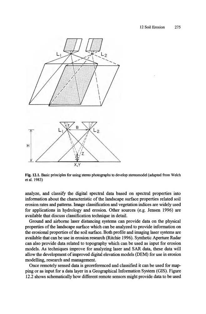
Fig. 12.1. Basic principles for using stereo photographs to develop stereomodel (adapted from WeIch
et al. 1983)
analyze, and classify the digital spectral data based on spectral properties into
information about the characteristic of the landscape surface properties related soil
erosion rates and patterns. Image classification and vegetation indices are widely used
for applications in hydrology and erosion. Other sources (e.g. Jensen 1996) are
available that discuss classification technique in detail.
Ground and airborne laser distancing systems can provide data on the physical
properties of the landscape surface which can be analyzed to provide information on
the erosional properties of the soil surface. Both profile and imaging laser systems are
available that can be use in erosion research (Ritchie 1996). Synthetic Aperture Radar
can also provide data related to topography which can be used as input for erosion
models. As techniques improve for analyzing laser and SAR data, these data will
allow the development of improved digital elevation models (D EM) for use in erosion
modelling, research and management.
Once remotely sensed data is georeferenced and classified it can be used for mapping or as input for a data layer in a Geographical Information System (GIS). Figure
12.2 shows schematically how different remote sensors might provide data to be used
275
H
Fig. 12.1. Basic principles for using stereo photographs to develop stereomodel (adapted from WeIch
et al. 1983)
analyze, and classify the digital spectral data based on spectral properties into
information about the characteristic of the landscape surface properties related soil
erosion rates and patterns. Image classification and vegetation indices are widely used
for applications in hydrology and erosion. Other sources (e.g. Jensen 1996) are
available that discuss classification technique in detail.
Ground and airborne laser distancing systems can provide data on the physical
properties of the landscape surface which can be analyzed to provide information on
the erosional properties of the soil surface. Both profile and imaging laser systems are
available that can be use in erosion research (Ritchie 1996). Synthetic Aperture Radar
can also provide data related to topography which can be used as input for erosion
models. As techniques improve for analyzing laser and SAR data, these data will
allow the development of improved digital elevation models (D EM) for use in erosion
modelling, research and management.
Once remotely sensed data is georeferenced and classified it can be used for mapping or as input for a data layer in a Geographical Information System (GIS). Figure
12.2 shows schematically how different remote sensors might provide data to be used