

Soil Moisture Estimation From SIR-C Imagery
April 12. 1994 - Oklahoma Transect (200 km x 29 km)
Oklahoma
Texas
AlI<3Ilsas
..........
..........
..........
..........
..........
,
-~""- . ",,,-Backscatter Image
PW"'\,~~ ~ -~
~,
..... ;:~
15.,..
30,..
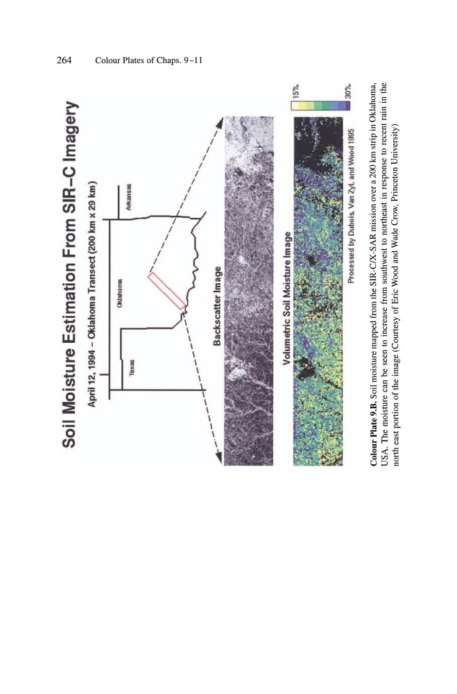
Colour Plate 9.B.
Soil moisture mapped from the SIR-C/X-SAR mission over a 200 km strip in Oklahoma,
USA. The moisture can be seen to increase from southwest to northeast in response to recent rain in the
north east portion
of the image (Courtesy of Eric Wood and Wade Crow, Princeton University)
tv
0\
.j:>.
n
o
0' "
...,
'"tI
0>
<>
'"
o
...,
n
::r
.§
' "
'D
J...
April 12. 1994 - Oklahoma Transect (200 km x 29 km)
Oklahoma
Texas
AlI<3Ilsas
..........
..........
..........
..........
..........
,
-~""- . ",,,-Backscatter Image
PW"'\,~~ ~ -~
~,
..... ;:~
15.,..
30,..
Colour Plate 9.B.
Soil moisture mapped from the SIR-C/X-SAR mission over a 200 km strip in Oklahoma,
USA. The moisture can be seen to increase from southwest to northeast in response to recent rain in the
north east portion
of the image (Courtesy of Eric Wood and Wade Crow, Princeton University)
tv
0\
.j:>.
n
o
0' "
...,
'"tI
0>
<>
'"
o
...,
n
::r
.§
' "
'D
J...