

11 Snow and Ice
249
11.3 Current Applications
11.3.1 NOHRSC - Snow Cover and Snow Water Equivalent Products
Because areal snow cover extent data have been available since the 1960s, various
investigators have found many useful applications. A team of scientists from a variety
of US government agencies developed plans in the early 1980s for operational snow
mapping by the US National Weather Service (NWS) for hydrological purposes. In
1986, NWS adopted these plans and proceeded to develop operational remote sensing
products, mostly for snow hydrology. The most widely distributed products of the
NWS National Operational Hydrologic Remote Sensing Center (NOHRSC) are
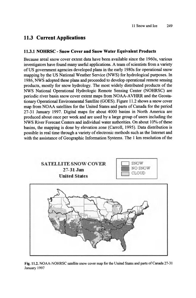
periodic river basin snow cover extent maps from NOAA-A VHRR and the Geostationary Operational Environmental Satellite (GOES). Figure 11.2 shows a snow cover
map from NOAA satellites for the United States and parts of Canada for the period
27-31 January 1997. Digital maps for about 4000 basins in North America are
produced about once per week and are used by a large group of users including the
NWS River Forecast Centers and individual water authorities. On about 10% of these
basins, the mapping is done by elevation zone (Carroll, 1995). Data distribution is
possible in real time through a variety of electronic methods such as the Internet and
with the assistance of Geographic Information Systems. The I km resolution of the
SATELLITE SNOW COVER
27-31 Jan
United States
CJ SNOW
NO SNOW
D CLOUD
Fig. 11 .2. NOAA-NOHRSC satellite snow cover map for the United States and parts of Canada 27-31
January 1997
249
11.3 Current Applications
11.3.1 NOHRSC - Snow Cover and Snow Water Equivalent Products
Because areal snow cover extent data have been available since the 1960s, various
investigators have found many useful applications. A team of scientists from a variety
of US government agencies developed plans in the early 1980s for operational snow
mapping by the US National Weather Service (NWS) for hydrological purposes. In
1986, NWS adopted these plans and proceeded to develop operational remote sensing
products, mostly for snow hydrology. The most widely distributed products of the
NWS National Operational Hydrologic Remote Sensing Center (NOHRSC) are
periodic river basin snow cover extent maps from NOAA-A VHRR and the Geostationary Operational Environmental Satellite (GOES). Figure 11.2 shows a snow cover
map from NOAA satellites for the United States and parts of Canada for the period
27-31 January 1997. Digital maps for about 4000 basins in North America are
produced about once per week and are used by a large group of users including the
NWS River Forecast Centers and individual water authorities. On about 10% of these
basins, the mapping is done by elevation zone (Carroll, 1995). Data distribution is
possible in real time through a variety of electronic methods such as the Internet and
with the assistance of Geographic Information Systems. The I km resolution of the
SATELLITE SNOW COVER
27-31 Jan
United States
CJ SNOW
NO SNOW
D CLOUD
Fig. 11 .2. NOAA-NOHRSC satellite snow cover map for the United States and parts of Canada 27-31
January 1997