

210
E.T. Engman
May 28.1987
,
I
,
,
, ,
40
June 4, 1987
\ s ou. " \ 10l101lIH".
: tl)YIOH L'
June 4. 1987
Sl'r\U tAPPW:OX,1
,00
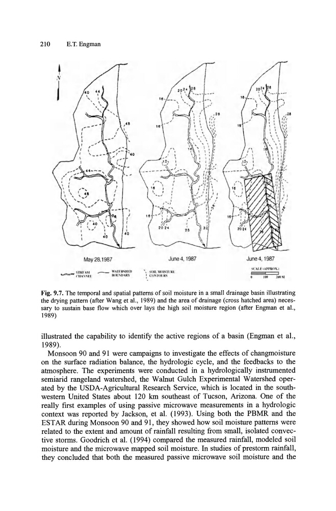
Fig. 9.7. The temporal and spatial patterns of soil moisture in a small drainage basin illustrating
the drying pattern (after Wang et aI., 1989) and the area of drainage (cross hatched area) necessary to sustain base flow which over lays the high soil moisture region (after Engman et aI.,
1989)
illustrated the capability to identify the active regions of a basin (Engman et aI.,
1989).
Monsoon 90 and 91 were campaigns to investigate the effects of changmoisture
on the surface radiation balance, the hydrologic cycle, and the feedbacks to the
atmosphere. The experiments were conducted in a hydrologically instrumented
semiarid rangeland watershed, the Walnut Gulch Experimental Watershed operated by the USDA-Agricultural Research Service, which is located in the southwestern United States about 120 km southeast of Tucson, Arizona. One of the
really first examples of using passive microwave measurements in a hydrologic
context was reported by Jackson, et al. (1993). Using both the PBMR and the
EST AR during Monsoon 90 and 91, they showed how soil moisture patterns were
related to the extent and amount of rainfall resulting from small, isolated convective storms. Goodrich et al. (1994) compared the measured rainfall, modeled soil
moisture and the microwave mapped soil moisture. In studies of prestorm rainfall,
they concluded that both the measured passive microwave soil moisture and the
E.T. Engman
May 28.1987
,
I
,
,
, ,
40
June 4, 1987
\ s ou. " \ 10l101lIH".
: tl)YIOH L'
June 4. 1987
Sl'r\U tAPPW:OX,1
,00
Fig. 9.7. The temporal and spatial patterns of soil moisture in a small drainage basin illustrating
the drying pattern (after Wang et aI., 1989) and the area of drainage (cross hatched area) necessary to sustain base flow which over lays the high soil moisture region (after Engman et aI.,
1989)
illustrated the capability to identify the active regions of a basin (Engman et aI.,
1989).
Monsoon 90 and 91 were campaigns to investigate the effects of changmoisture
on the surface radiation balance, the hydrologic cycle, and the feedbacks to the
atmosphere. The experiments were conducted in a hydrologically instrumented
semiarid rangeland watershed, the Walnut Gulch Experimental Watershed operated by the USDA-Agricultural Research Service, which is located in the southwestern United States about 120 km southeast of Tucson, Arizona. One of the
really first examples of using passive microwave measurements in a hydrologic
context was reported by Jackson, et al. (1993). Using both the PBMR and the
EST AR during Monsoon 90 and 91, they showed how soil moisture patterns were
related to the extent and amount of rainfall resulting from small, isolated convective storms. Goodrich et al. (1994) compared the measured rainfall, modeled soil
moisture and the microwave mapped soil moisture. In studies of prestorm rainfall,
they concluded that both the measured passive microwave soil moisture and the