

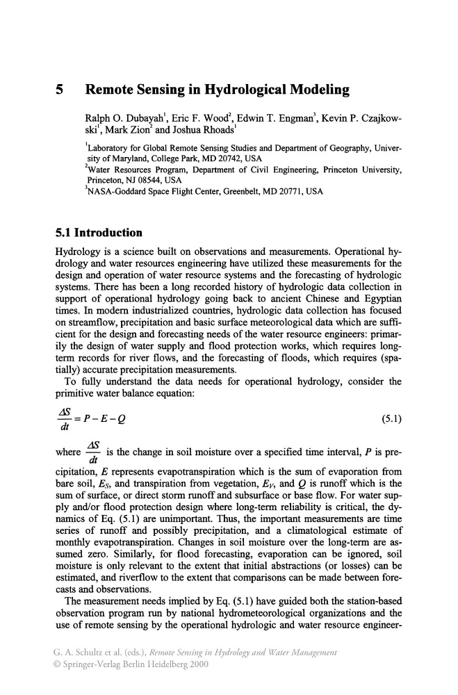
5
Remote Sensing in Hydrological Modeling
Ralph O. Dubayah', Eric F. Wood 2 , Edwin T. Engman\ Kevin P. Czajkowski', Mark Zion 2 and Joshua Rhoads'
'Laboratory for Global Remote Sensing Studies and Department of Geography, University of Maryland, College Park, MD 20742, USA
2Water Resources Program, Department of Civil Engineering, Princeton University,
Princeton, NJ 08544, USA
JNASA-Goddard Space Flight Center, Greenbelt, MD 20771, USA
5.1 Introduction
Hydrology is a science built on observations and measurements. Operational hydrology and water resources engineering have utilized these measurements for the
design and operation of water resource systems and the forecasting of hydrologic
systems. There has been a long recorded history of hydrologic data collection in
support of operational hydrology going back to ancient Chinese and Egyptian
times. In modem industrialized countries, hydrologic data collection has focused
on streamflow, precipitation and basic surface meteorological data which are sufficient for the design and forecasting needs of the water resource engineers: primarily the design of water supply and flood protection works, which requires longterm records for river flows, and the forecasting of floods, which requires (spatially) accurate precipitation measurements.
To fully understand the data needs for operational hydrology, consider the
primitive water balance equation:
L1S
-=P-E-Q
dt
(5.1)
where L1S is the change in soil moisture over a specified time interval, P is predt
cipitation, E represents evapotranspiration which is the sum of evaporation from
bare soil, Es, and transpiration from vegetation, E v, and Q is runoff which is the
sum of surface, or direct storm runoff and subsurface or base flow. For water supply and/or flood protection design where long-term reliability is critical, the dynamics of Eq. (5.1) are unimportant. Thus, the important measurements are time
series of runoff and possibly precipitation, and a climatological estimate of
monthly evapotranspiration. Changes in soil moisture over the long-term are assumed zero. Similarly, for flood forecasting, evaporation can be ignored, soil
moisture is only relevant to the extent that initial abstractions (or losses) can be
estimated, and riverflow to the extent that comparisons can be made between forecasts and observations.
The measurement needs implied by Eq. (5.1) have guided both the station-based
observation program run by national hydrometeorological organizations and the
use of remote sensing by the operational hydrologic and water resource engineerG. A. Schultz et al. (eds.), Remote Sensing in Hydrology and Water Management
© Springer-Verlag Berlin Heidelberg 2000
Remote Sensing in Hydrological Modeling
Ralph O. Dubayah', Eric F. Wood 2 , Edwin T. Engman\ Kevin P. Czajkowski', Mark Zion 2 and Joshua Rhoads'
'Laboratory for Global Remote Sensing Studies and Department of Geography, University of Maryland, College Park, MD 20742, USA
2Water Resources Program, Department of Civil Engineering, Princeton University,
Princeton, NJ 08544, USA
JNASA-Goddard Space Flight Center, Greenbelt, MD 20771, USA
5.1 Introduction
Hydrology is a science built on observations and measurements. Operational hydrology and water resources engineering have utilized these measurements for the
design and operation of water resource systems and the forecasting of hydrologic
systems. There has been a long recorded history of hydrologic data collection in
support of operational hydrology going back to ancient Chinese and Egyptian
times. In modem industrialized countries, hydrologic data collection has focused
on streamflow, precipitation and basic surface meteorological data which are sufficient for the design and forecasting needs of the water resource engineers: primarily the design of water supply and flood protection works, which requires longterm records for river flows, and the forecasting of floods, which requires (spatially) accurate precipitation measurements.
To fully understand the data needs for operational hydrology, consider the
primitive water balance equation:
L1S
-=P-E-Q
dt
(5.1)
where L1S is the change in soil moisture over a specified time interval, P is predt
cipitation, E represents evapotranspiration which is the sum of evaporation from
bare soil, Es, and transpiration from vegetation, E v, and Q is runoff which is the
sum of surface, or direct storm runoff and subsurface or base flow. For water supply and/or flood protection design where long-term reliability is critical, the dynamics of Eq. (5.1) are unimportant. Thus, the important measurements are time
series of runoff and possibly precipitation, and a climatological estimate of
monthly evapotranspiration. Changes in soil moisture over the long-term are assumed zero. Similarly, for flood forecasting, evaporation can be ignored, soil
moisture is only relevant to the extent that initial abstractions (or losses) can be
estimated, and riverflow to the extent that comparisons can be made between forecasts and observations.
The measurement needs implied by Eq. (5.1) have guided both the station-based
observation program run by national hydrometeorological organizations and the
use of remote sensing by the operational hydrologic and water resource engineerG. A. Schultz et al. (eds.), Remote Sensing in Hydrology and Water Management
© Springer-Verlag Berlin Heidelberg 2000