

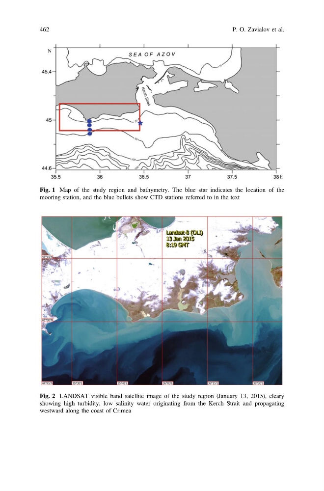
Fig. 1 Map of the study region and bathymetry. The blue star indicates the location of the
mooring station, and the blue bullets show CTD stations referred to in the text
Fig. 2 LANDSAT visible band satellite image of the study region (January 13, 2015), cleary
showing high turbidity, low salinity water originating from the Kerch Strait and propagating
westward along the coast of Crimea
462
P. O. Zavialov et al.
mooring station, and the blue bullets show CTD stations referred to in the text
Fig. 2 LANDSAT visible band satellite image of the study region (January 13, 2015), cleary
showing high turbidity, low salinity water originating from the Kerch Strait and propagating
westward along the coast of Crimea
462
P. O. Zavialov et al.