

Part B | 14
342 Part B Autonomous Ocean Vehicles, Subsystems and Control
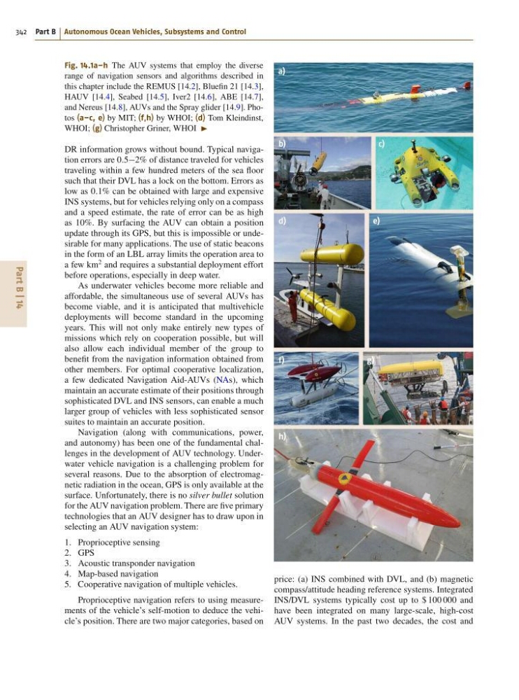
Fig. 14.1a–h The AUV systems that employ the diverse
range of navigation sensors and algorithms described in
this chapter include the REMUS [14.2], Bluefin 21 [14.3],
HAUV [14.4], Seabed [14.5], Iver2 [14.6], ABE [14.7],
and Nereus [14.8], AUVs and the Spray glider [14.9]. Photos (a–c, e) by MIT; (f,h) by WHOI; (d) Tom Kleindinst,
WHOI; (g) Christopher Griner, WHOI I
DR information grows without bound. Typical navigation errors are 0:52% of distance traveled for vehicles
traveling within a few hundred meters of the sea floor
such that their DVL has a lock on the bottom. Errors as
low as 0:1% can be obtained with large and expensive
INS systems, but for vehicles relying only on a compass
and a speed estimate, the rate of error can be as high
as 10%. By surfacing the AUV can obtain a position
update through its GPS, but this is impossible or undesirable for many applications. The use of static beacons
in the form of an LBL array limits the operation area to
a few km
2 and requires a substantial deployment effort
before operations, especially in deep water.
As underwater vehicles become more reliable and
affordable, the simultaneous use of several AUVs has
become viable, and it is anticipated that multivehicle
deployments will become standard in the upcoming
years. This will not only make entirely new types of
missions which rely on cooperation possible, but will
also allow each individual member of the group to
benefit from the navigation information obtained from
other members. For optimal cooperative localization,
a few dedicated Navigation Aid-AUVs (NAs), which
maintain an accurate estimate of their positions through
sophisticated DVL and INS sensors, can enable a much
larger group of vehicles with less sophisticated sensor
suites to maintain an accurate position.
Navigation (along with communications, power,
and autonomy) has been one of the fundamental challenges in the development of AUV technology. Underwater vehicle navigation is a challenging problem for
several reasons. Due to the absorption of electromagnetic radiation in the ocean, GPS is only available at the
surface. Unfortunately, there is no silver bullet solution
for the AUV navigation problem. There are five primary
technologies that an AUV designer has to draw upon in
selecting an AUV navigation system:
1. Proprioceptive sensing
2. GPS
3. Acoustic transponder navigation
4. Map-based navigation
5. Cooperative navigation of multiple vehicles.
Proprioceptive navigation refers to using measurements of the vehicle’s self-motion to deduce the vehicle’s position. There are two major categories, based on
a)
b)
c)
d)
e)
f)
h)
g)
price: (a) INS combined with DVL, and (b) magnetic
compass/attitude heading reference systems. Integrated
INS/DVL systems typically cost up to $ 100 000 and
have been integrated on many large-scale, high-cost
AUV systems. In the past two decades, the cost and
342 Part B Autonomous Ocean Vehicles, Subsystems and Control
Fig. 14.1a–h The AUV systems that employ the diverse
range of navigation sensors and algorithms described in
this chapter include the REMUS [14.2], Bluefin 21 [14.3],
HAUV [14.4], Seabed [14.5], Iver2 [14.6], ABE [14.7],
and Nereus [14.8], AUVs and the Spray glider [14.9]. Photos (a–c, e) by MIT; (f,h) by WHOI; (d) Tom Kleindinst,
WHOI; (g) Christopher Griner, WHOI I
DR information grows without bound. Typical navigation errors are 0:52% of distance traveled for vehicles
traveling within a few hundred meters of the sea floor
such that their DVL has a lock on the bottom. Errors as
low as 0:1% can be obtained with large and expensive
INS systems, but for vehicles relying only on a compass
and a speed estimate, the rate of error can be as high
as 10%. By surfacing the AUV can obtain a position
update through its GPS, but this is impossible or undesirable for many applications. The use of static beacons
in the form of an LBL array limits the operation area to
a few km
2 and requires a substantial deployment effort
before operations, especially in deep water.
As underwater vehicles become more reliable and
affordable, the simultaneous use of several AUVs has
become viable, and it is anticipated that multivehicle
deployments will become standard in the upcoming
years. This will not only make entirely new types of
missions which rely on cooperation possible, but will
also allow each individual member of the group to
benefit from the navigation information obtained from
other members. For optimal cooperative localization,
a few dedicated Navigation Aid-AUVs (NAs), which
maintain an accurate estimate of their positions through
sophisticated DVL and INS sensors, can enable a much
larger group of vehicles with less sophisticated sensor
suites to maintain an accurate position.
Navigation (along with communications, power,
and autonomy) has been one of the fundamental challenges in the development of AUV technology. Underwater vehicle navigation is a challenging problem for
several reasons. Due to the absorption of electromagnetic radiation in the ocean, GPS is only available at the
surface. Unfortunately, there is no silver bullet solution
for the AUV navigation problem. There are five primary
technologies that an AUV designer has to draw upon in
selecting an AUV navigation system:
1. Proprioceptive sensing
2. GPS
3. Acoustic transponder navigation
4. Map-based navigation
5. Cooperative navigation of multiple vehicles.
Proprioceptive navigation refers to using measurements of the vehicle’s self-motion to deduce the vehicle’s position. There are two major categories, based on
a)
b)
c)
d)
e)
f)
h)
g)
price: (a) INS combined with DVL, and (b) magnetic
compass/attitude heading reference systems. Integrated
INS/DVL systems typically cost up to $ 100 000 and
have been integrated on many large-scale, high-cost
AUV systems. In the past two decades, the cost and