

117
In the USA, NOAA supports a National Operational Coastal Modeling Program
(NOCMP) with the mission of building and maintaining an Operational Nowcast
and Forecast Hydrodynamic Model Systems (OFS) (https://tidesandcurrents.noaa.
gov/models.html accessed 8/9/2017). These OFS supplement astronomical tidal
predictions by incorporating additional free surface movements along the coastline
taking into account storm tides and wave setup. OFS also provide hindcasts, nowcasts, and forecasts of current speed and direction, water temperature, and salinity.
Specific forecasting OFS systems are targeted to cover critical estuaries, ports, and
harbors, but diverse computational engines are in use for specific regions as
described below.
Currently, operation regional NOAA OFS models for the US east coast include
the Delaware and Chesapeake Bays OFS, using ROMS, the St. Johns River (Florida)
Estuary, and the Ports of NY and NJ OFS, using the Environmental Fluid Dynamics
Code, a model similar to POM in physics and computational code, the Northern Gulf
of Mexico OFS operating a version of FVCOM and the Tampa Bay OFS using
ROMS. Two high-resolution OFS are operational on the US West coast: the Columbia
River Estuary OFS operating SELFE and the San Francisco Bay OFS using
FVCOM. NOAA also supports 11 regional ICOOS systems operated by regional
associations each of which either implements regional scale models to address
region-specific problems or serves national scale models in region-specific formats.
An example of an institutional model is the New York Harbor Observing and
Prediction System (NYHOPS), operated by Steven Institute of Technology in
Hoboken, New Jersey. The model, based on the Princeton Ocean Model (POM),
ingests meteorological and oceanographic data from a large number of sensors
within the harbor, up the Hudson River and in the NY Bight, and provides forecasts.
NYHOPS has received much attention due to its successful assistance in resolving
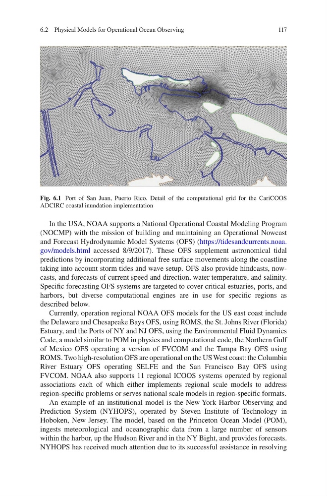
Fig. 6.1 Port of San Juan, Puerto Rico. Detail of the computational grid for the CariCOOS
ADCIRC coastal inundation implementation
6.2 Physical Models for Operational Ocean Observing
In the USA, NOAA supports a National Operational Coastal Modeling Program
(NOCMP) with the mission of building and maintaining an Operational Nowcast
and Forecast Hydrodynamic Model Systems (OFS) (https://tidesandcurrents.noaa.
gov/models.html accessed 8/9/2017). These OFS supplement astronomical tidal
predictions by incorporating additional free surface movements along the coastline
taking into account storm tides and wave setup. OFS also provide hindcasts, nowcasts, and forecasts of current speed and direction, water temperature, and salinity.
Specific forecasting OFS systems are targeted to cover critical estuaries, ports, and
harbors, but diverse computational engines are in use for specific regions as
described below.
Currently, operation regional NOAA OFS models for the US east coast include
the Delaware and Chesapeake Bays OFS, using ROMS, the St. Johns River (Florida)
Estuary, and the Ports of NY and NJ OFS, using the Environmental Fluid Dynamics
Code, a model similar to POM in physics and computational code, the Northern Gulf
of Mexico OFS operating a version of FVCOM and the Tampa Bay OFS using
ROMS. Two high-resolution OFS are operational on the US West coast: the Columbia
River Estuary OFS operating SELFE and the San Francisco Bay OFS using
FVCOM. NOAA also supports 11 regional ICOOS systems operated by regional
associations each of which either implements regional scale models to address
region-specific problems or serves national scale models in region-specific formats.
An example of an institutional model is the New York Harbor Observing and
Prediction System (NYHOPS), operated by Steven Institute of Technology in
Hoboken, New Jersey. The model, based on the Princeton Ocean Model (POM),
ingests meteorological and oceanographic data from a large number of sensors
within the harbor, up the Hudson River and in the NY Bight, and provides forecasts.
NYHOPS has received much attention due to its successful assistance in resolving
Fig. 6.1 Port of San Juan, Puerto Rico. Detail of the computational grid for the CariCOOS
ADCIRC coastal inundation implementation
6.2 Physical Models for Operational Ocean Observing