

26
Multiscale Hydrologic Remote Sensing: Perspectives and Applications
fully investigate soil moisture patterns and to relate them to soil and/or topographic
attributes.
2.5 CONCLUSIONS
In this chapter, we emphasized the high capabilities of GPR for soil moisture characterization at the field scale in order to bridge the scale gap in soil moisture sensing between large-scale remote sensing platforms and small-scale invasive sensors.
We presented an advanced off-ground GPR method for quantitatively measuring
soil moisture based on the VNA technology and an accurate 3-D modeling of GPR
wave propagation in the antenna–soil system. It is worth noting that this GPR
approach also applies to common time-domain GPR systems. This proximal sensing GPR method proved to be particularly appropriate for soil moisture mapping at
15/03/2010
18/03/2010
24/03/2010
30/03/2010
06/04/2010
m
0 25 50 75 100
0.15
0.40
N
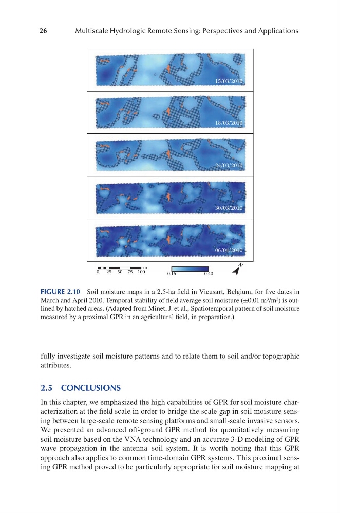
FIGURE 2.10 Soil moisture maps in a 2.5-ha field in Vieusart, Belgium, for five dates in
March and April 2010. Temporal stability of field average soil moisture (±0.01 m 3 /m 3 ) is outlined by hatched areas. (Adapted from Minet, J. et al., Spatiotemporal pattern of soil moisture
measured by a proximal GPR in an agricultural field, in preparation.)
Multiscale Hydrologic Remote Sensing: Perspectives and Applications
fully investigate soil moisture patterns and to relate them to soil and/or topographic
attributes.
2.5 CONCLUSIONS
In this chapter, we emphasized the high capabilities of GPR for soil moisture characterization at the field scale in order to bridge the scale gap in soil moisture sensing between large-scale remote sensing platforms and small-scale invasive sensors.
We presented an advanced off-ground GPR method for quantitatively measuring
soil moisture based on the VNA technology and an accurate 3-D modeling of GPR
wave propagation in the antenna–soil system. It is worth noting that this GPR
approach also applies to common time-domain GPR systems. This proximal sensing GPR method proved to be particularly appropriate for soil moisture mapping at
15/03/2010
18/03/2010
24/03/2010
30/03/2010
06/04/2010
m
0 25 50 75 100
0.15
0.40
N
FIGURE 2.10 Soil moisture maps in a 2.5-ha field in Vieusart, Belgium, for five dates in
March and April 2010. Temporal stability of field average soil moisture (±0.01 m 3 /m 3 ) is outlined by hatched areas. (Adapted from Minet, J. et al., Spatiotemporal pattern of soil moisture
measured by a proximal GPR in an agricultural field, in preparation.)