

261
Multispectral Satellite Data for Flood Monitoring and Inundation Mapping
0°30'N
0°20'N
0°10'N
0°10'S
0°20'S
33°50'E 34°0'E 34°10'E 34°20'E
0°0'
MODIS flood detection
Nzoia River
Nzoia River Basin
Lake Victoria
Country boundary
High: 4122
Low: 952
Elevation (m)
Lake Victoria
Lake Victoria
Kenya
Aug 15, 2007
(DOY 227)
Aug 15, 2007
(DOY 227)
Kenya
N z o ia R iv e r
Uganda
Uganda
(b1)
(b2)
N
(a1)
(a2)
0°30'N
0°20'N
0°10'N
0°10'S
0°20'S
0°0'
33°50'E 34°0'E 34°10'E 34°20'E
Lake Victoria
Kenya
N z o ia R iv e r
Uganda
N
Dec 4, 2006
(DOY 338)
Lake Victoria
Kenya
N z o ia R iv e r
Uganda
MODIS flood detection
Nzoia River
Nzoia River Basin
Lake Victoria
Country boundary
High: 4122
Low: 952
Elevation (m)
Dec 4, 2006
(DOY 338)
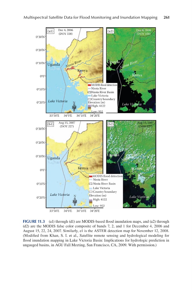
FIGURE 11.3 (a1) through (d1) are MODIS-based flood inundation maps, and (a2) through
(d2) are the MODIS false color composite of bands 7, 2, and 1 for December 4, 2006 and
August 15, 22, 24, 2007. Similarly, e1 is the ASTER detection map for November 12, 2008.
(Modified from Khan, S. I. et al., Satellite remote sensing and hydrological modeling for
flood inundation mapping in Lake Victoria Basin: Implications for hydrologic prediction in
ungauged basins, in AGU Fall Meeting, San Francisco, CA, 2009. With permission.)
Multispectral Satellite Data for Flood Monitoring and Inundation Mapping
0°30'N
0°20'N
0°10'N
0°10'S
0°20'S
33°50'E 34°0'E 34°10'E 34°20'E
0°0'
MODIS flood detection
Nzoia River
Nzoia River Basin
Lake Victoria
Country boundary
High: 4122
Low: 952
Elevation (m)
Lake Victoria
Lake Victoria
Kenya
Aug 15, 2007
(DOY 227)
Aug 15, 2007
(DOY 227)
Kenya
N z o ia R iv e r
Uganda
Uganda
(b1)
(b2)
N
(a1)
(a2)
0°30'N
0°20'N
0°10'N
0°10'S
0°20'S
0°0'
33°50'E 34°0'E 34°10'E 34°20'E
Lake Victoria
Kenya
N z o ia R iv e r
Uganda
N
Dec 4, 2006
(DOY 338)
Lake Victoria
Kenya
N z o ia R iv e r
Uganda
MODIS flood detection
Nzoia River
Nzoia River Basin
Lake Victoria
Country boundary
High: 4122
Low: 952
Elevation (m)
Dec 4, 2006
(DOY 338)
FIGURE 11.3 (a1) through (d1) are MODIS-based flood inundation maps, and (a2) through
(d2) are the MODIS false color composite of bands 7, 2, and 1 for December 4, 2006 and
August 15, 22, 24, 2007. Similarly, e1 is the ASTER detection map for November 12, 2008.
(Modified from Khan, S. I. et al., Satellite remote sensing and hydrological modeling for
flood inundation mapping in Lake Victoria Basin: Implications for hydrologic prediction in
ungauged basins, in AGU Fall Meeting, San Francisco, CA, 2009. With permission.)