

160
Multiscale Hydrologic Remote Sensing: Perspectives and Applications
7.5 CONCLUSIONS
This chapter has presented a spatial and temporal, synergistic investigation between
two types of drought indices associated with two satellite-based LULC maps of part
of the Laizhou Bay in Shandong, China, in 1987 and 2000. With the aid of advanced
contemporary remote sensing technologies, cross linkages and cross comparisons
(a)
(b)
N
0
5
10
20
km
Legend
ANDVI in 1987
High: 0.44
Low: -0.15
N
0
5
10
20
km
Legend
ANDVI in 2000
High: 0.35
Low: -0.21
N
0 .5 1
2
3
4
km
Legend
ANDVI in 1987
Legend
ANDVI in 2000
< 0
0-0.03
0.04-0.19
> 0.19
N
< 0
0-0.03
0.04-0.19
> 0.19
0 .5 1
2
3
4
km
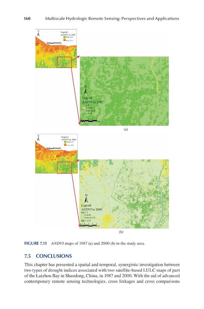
FIGURE 7.11 ANDVI maps of 1987 (a) and 2000 (b) in the study area.
Multiscale Hydrologic Remote Sensing: Perspectives and Applications
7.5 CONCLUSIONS
This chapter has presented a spatial and temporal, synergistic investigation between
two types of drought indices associated with two satellite-based LULC maps of part
of the Laizhou Bay in Shandong, China, in 1987 and 2000. With the aid of advanced
contemporary remote sensing technologies, cross linkages and cross comparisons
(a)
(b)
N
0
5
10
20
km
Legend
ANDVI in 1987
High: 0.44
Low: -0.15
N
0
5
10
20
km
Legend
ANDVI in 2000
High: 0.35
Low: -0.21
N
0 .5 1
2
3
4
km
Legend
ANDVI in 1987
Legend
ANDVI in 2000
< 0
0-0.03
0.04-0.19
> 0.19
N
< 0
0-0.03
0.04-0.19
> 0.19
0 .5 1
2
3
4
km
FIGURE 7.11 ANDVI maps of 1987 (a) and 2000 (b) in the study area.