

118
Multiscale Hydrologic Remote Sensing: Perspectives and Applications
Tampa watersheds
Rivers
Open water
Barren land
Cultivated crops
Deciduous forest
Developed, high intensity
Developed, low intensity
Developed, medium intensity
Developed, open space
Emergent herbaceous wetlands
Evergreen forest
Hay/pasture
Herbaceous
Mixed forest
Open water
Perennial snow/ice
Shrub/scrub
Woody wetlands
Landcover
Ground truth 29Dec09
Rivers
0 3 6 12 18 24
km
0 2 4 8 12 16
N
S
W
E
N
S
W
E
km
Tampa watersheds
(a)
(b)
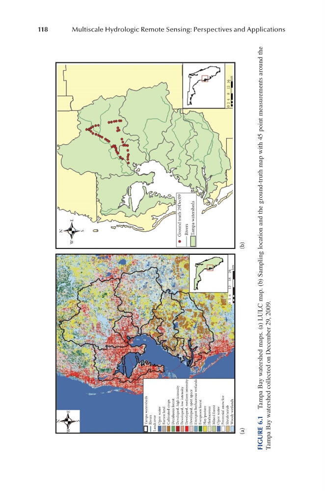
FIGURE 6.1 Tampa Bay watershed maps. (a) LULC map. (b) Sampling location and the ground-truth map with 45 point measurements around the
Tampa Bay watershed collected on December 29, 2009.
Multiscale Hydrologic Remote Sensing: Perspectives and Applications
Tampa watersheds
Rivers
Open water
Barren land
Cultivated crops
Deciduous forest
Developed, high intensity
Developed, low intensity
Developed, medium intensity
Developed, open space
Emergent herbaceous wetlands
Evergreen forest
Hay/pasture
Herbaceous
Mixed forest
Open water
Perennial snow/ice
Shrub/scrub
Woody wetlands
Landcover
Ground truth 29Dec09
Rivers
0 3 6 12 18 24
km
0 2 4 8 12 16
N
S
W
E
N
S
W
E
km
Tampa watersheds
(a)
(b)
FIGURE 6.1 Tampa Bay watershed maps. (a) LULC map. (b) Sampling location and the ground-truth map with 45 point measurements around the
Tampa Bay watershed collected on December 29, 2009.