

the cold zone, and the lack of precipitation in
the arid zone.
4. Differences in climatic regime are used to
define ecosystem boundaries (Troll 1966).
One can illustrate different climatic regimes
by studying climate diagrams, or
climographs (Walter et al. 1975). For example, tropical rainforest climates lack seasonal
periodicity, whereas mid-latitude steppe
climates have pronounced seasons. Climate
diagrams show temperature and precipitation
values but also the duration and intensity of
relatively humid and relatively arid seasons,
the severity of a cold winter, and the possibility of late or early frosts. With this information, it is possible to judge the climate from an
ecological standpoint.
5. Seasonality of precipitation affects the potential distribution of vegetation and must be
considered in setting up ecoclimatic zones.
Within the arid zone, for example, deserts
that receive only winter rain (Mojave Desert)
can be distinguished from those that receive
only summer rain (Chihuahuan Desert).
Within the steppe zone, a semiarid steppe
(short-grass prairie) climate that has a dry
summer season and occasional drought can
be distinguished from an arid semidesert
(sagebrush shrubland) climate that has a very
pronounced drought season plus a short humid
season. The Great Plains grasslands are
associated with the near absence of winter
rains and the presence of spring rains.
6. The delimitation of the ecological climates
must incorporate the degree of dryness or of
cold. These two factors affect the distribution of vegetation. For example, the vegetation of the tropical savanna (wet–dry
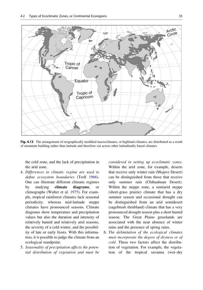
Fig. 4.13 The arrangement of orographically modified macroclimates, or highland climates, are distributed as a result
of mountain building rather than latitude and therefore cut across other latitudinally based climates
4.2 Types of Ecoclimatic Zones, or Continental Ecoregions
35
the arid zone.
4. Differences in climatic regime are used to
define ecosystem boundaries (Troll 1966).
One can illustrate different climatic regimes
by studying climate diagrams, or
climographs (Walter et al. 1975). For example, tropical rainforest climates lack seasonal
periodicity, whereas mid-latitude steppe
climates have pronounced seasons. Climate
diagrams show temperature and precipitation
values but also the duration and intensity of
relatively humid and relatively arid seasons,
the severity of a cold winter, and the possibility of late or early frosts. With this information, it is possible to judge the climate from an
ecological standpoint.
5. Seasonality of precipitation affects the potential distribution of vegetation and must be
considered in setting up ecoclimatic zones.
Within the arid zone, for example, deserts
that receive only winter rain (Mojave Desert)
can be distinguished from those that receive
only summer rain (Chihuahuan Desert).
Within the steppe zone, a semiarid steppe
(short-grass prairie) climate that has a dry
summer season and occasional drought can
be distinguished from an arid semidesert
(sagebrush shrubland) climate that has a very
pronounced drought season plus a short humid
season. The Great Plains grasslands are
associated with the near absence of winter
rains and the presence of spring rains.
6. The delimitation of the ecological climates
must incorporate the degree of dryness or of
cold. These two factors affect the distribution of vegetation. For example, the vegetation of the tropical savanna (wet–dry
Fig. 4.13 The arrangement of orographically modified macroclimates, or highland climates, are distributed as a result
of mountain building rather than latitude and therefore cut across other latitudinally based climates
4.2 Types of Ecoclimatic Zones, or Continental Ecoregions
35