

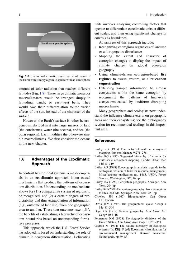
amount of solar radiation that reaches different
latitudes (Fig. 1.8). These large climatic zones, or
macroclimates, would be arranged simply in
latitudinal bands, or east–west belts. They
would owe their differentiation to the varied
effects of the sun, instead of the character of the
surface.
However, the Earth’s surface is rather heterogeneous, divided first into large masses of land
(the continents), water (the oceans), and ice (the
polar regions). Each modifies the otherwise simple macroclimates. We first consider the oceans
in the next chapter.
1.6
Advantages of the Ecoclimatic
Approach
In contrast to empirical systems, a major emphasis in an ecoclimatic approach is on causal
mechanisms that produce the patterns of ecosystem distribution. Understanding the mechanisms
allows for (1) a comparative system of regions to
be recognized, and (2) a certain degree of predictability and thus extrapolation of information
(e.g., outcome of land use) from one geographic
area to another. These two outcomes exemplify
the benefits of establishing a hierarchy of ecosystem boundaries based on understanding formative processes.
This approach, which the U.S. Forest Service
has adopted, is based on understanding the role of
climate in ecosystem differentiation. Delineating
units involves analyzing controlling factors that
operate to differentiate ecoclimatic units at different scales, and then using significant changes in
controls as boundaries.
Advantages of this approach include:
• Recognizing ecoregions regardless of land use
or anthropogenic disturbance
• Mapping the extent and character of
ecoregion changes to display the impact of
climate change on global ecoregion
geography
• Using climate-driven ecoregion-based fire
regimes to assess, restore, or alter carbon
sequestration
• Extending sample information to similar
ecosystems within the same ecoregion by
recognizing the patterns of finer-scale
ecosystems caused by landforms disrupting
macroclimate
Many geographers and ecologists now understand the influence climate exerts on geographic
areas and their ecosystems; see the bibliography
section for recommended readings in this important area.
References
Bailey RG (1985) The factor of scale in ecosystem
mapping. Environ Manage 9:271–276
Bailey RG (1987) Suggested hierarchy of criteria for
multi-scale ecosystem mapping. Landsc Urban Plan
14:313–319
Bailey RG (1988) Ecogeographic analysis: a guide to the
ecological division of land for resource management.
Miscellaneous publication no. 1465. USDA Forest
Service, Washington, DC, 16 pp
Bailey RG (1996) Ecosystem geography. Springer, New
York, 204 pp
Bailey RG (2009) Ecosystem geography: from ecoregions
to sites, 2nd edn. Springer, New York, 251 pp
Crowley JM (1967) Biogeography. Can Geogr
11:312–326
Davis WM (1899) The geographical cycle. Geogr J
14:481–504
Dryer CR (1919) Genetic geography. Ann Assoc Am
Geogr 10:3–16
Fenneman NM (1928) Physiographic divisions of the
United States. Ann Assoc Am Geogr 18:261–353
Godron M (1994) The natural hierarchy of ecological
systems. In: Klijn F (ed) Ecosystem classification for
environmental management. Kluwer Academic,
Netherlands, pp 69–83
Fig. 1.8 Latitudinal climatic zones that would result if
the Earth were simply a granite sphere with an atmosphere
6
1 Introduction
latitudes (Fig. 1.8). These large climatic zones, or
macroclimates, would be arranged simply in
latitudinal bands, or east–west belts. They
would owe their differentiation to the varied
effects of the sun, instead of the character of the
surface.
However, the Earth’s surface is rather heterogeneous, divided first into large masses of land
(the continents), water (the oceans), and ice (the
polar regions). Each modifies the otherwise simple macroclimates. We first consider the oceans
in the next chapter.
1.6
Advantages of the Ecoclimatic
Approach
In contrast to empirical systems, a major emphasis in an ecoclimatic approach is on causal
mechanisms that produce the patterns of ecosystem distribution. Understanding the mechanisms
allows for (1) a comparative system of regions to
be recognized, and (2) a certain degree of predictability and thus extrapolation of information
(e.g., outcome of land use) from one geographic
area to another. These two outcomes exemplify
the benefits of establishing a hierarchy of ecosystem boundaries based on understanding formative processes.
This approach, which the U.S. Forest Service
has adopted, is based on understanding the role of
climate in ecosystem differentiation. Delineating
units involves analyzing controlling factors that
operate to differentiate ecoclimatic units at different scales, and then using significant changes in
controls as boundaries.
Advantages of this approach include:
• Recognizing ecoregions regardless of land use
or anthropogenic disturbance
• Mapping the extent and character of
ecoregion changes to display the impact of
climate change on global ecoregion
geography
• Using climate-driven ecoregion-based fire
regimes to assess, restore, or alter carbon
sequestration
• Extending sample information to similar
ecosystems within the same ecoregion by
recognizing the patterns of finer-scale
ecosystems caused by landforms disrupting
macroclimate
Many geographers and ecologists now understand the influence climate exerts on geographic
areas and their ecosystems; see the bibliography
section for recommended readings in this important area.
References
Bailey RG (1985) The factor of scale in ecosystem
mapping. Environ Manage 9:271–276
Bailey RG (1987) Suggested hierarchy of criteria for
multi-scale ecosystem mapping. Landsc Urban Plan
14:313–319
Bailey RG (1988) Ecogeographic analysis: a guide to the
ecological division of land for resource management.
Miscellaneous publication no. 1465. USDA Forest
Service, Washington, DC, 16 pp
Bailey RG (1996) Ecosystem geography. Springer, New
York, 204 pp
Bailey RG (2009) Ecosystem geography: from ecoregions
to sites, 2nd edn. Springer, New York, 251 pp
Crowley JM (1967) Biogeography. Can Geogr
11:312–326
Davis WM (1899) The geographical cycle. Geogr J
14:481–504
Dryer CR (1919) Genetic geography. Ann Assoc Am
Geogr 10:3–16
Fenneman NM (1928) Physiographic divisions of the
United States. Ann Assoc Am Geogr 18:261–353
Godron M (1994) The natural hierarchy of ecological
systems. In: Klijn F (ed) Ecosystem classification for
environmental management. Kluwer Academic,
Netherlands, pp 69–83
Fig. 1.8 Latitudinal climatic zones that would result if
the Earth were simply a granite sphere with an atmosphere
6
1 Introduction